Travel by Car
What is the fastest way to drive to Weirs Beach? The easiest way?
There are two equally FAST ways, if you are driving from Manchester, NH ; Boston, MA; or other points to the South and West of Weirs Beach. Make your decision which way to go before you get to Concord, NH. The first route will take you past the Tanger Outlet Center in Tilton (opened in July 1994), while the second, past the New Hampshire Motor Speedway in Loudon (opened in June 1990). Each route takes about 45 minutes from Concord.
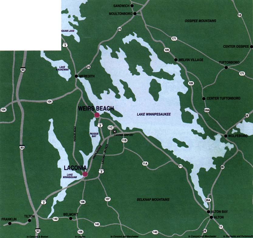
1) From Route 93 North in Concord, NH, stay on 93 until Exit 20, then go left and follow Route 3 North all the way to Weirs Beach. The outlet stores are on the left a short distance from the exit. Continue about 7 miles north, past Lake Winnisquam. Shortly after passing the Belknap Mall (603) 524-5651 on your left, take a right onto the Laconia Bypass highway. (Or instead, continue straight ahead to downtown Laconia, where there are a wide variety of fine shops and restaurants.) When the highway ends, bear right. In about a mile, immediately after the Winnipesaukee Plaza/Lowe’s on the left and the Gilford Mobil Mart (603) 524-8014 on the right, take a right. Follow Weirs Boulevard for 3 miles along Paugus Bay to Weirs Beach.
2) From Route 93 North in Concord, take Exit 15E to Route 393 East. In about 3 miles exit to Route 106 North. In about 10 miles you’ll pass the speedway. In about another ten miles, while descending a hill you’ll pass some car dealerships. Near the bottom of that hill take a right, joining Route 3 north onto the Laconia Bypass highway. (Or instead, continue straight ahead to downtown Laconia, where there are a wide variety of fine shops and restaurants.) Stay on route 3 north the rest of the way to Weirs Beach. When the bypass highway ends, bear right. In about a mile, immediately after the Winnipesaukee Plaza/Lowe’s on the left and the Gilford Mobil Mart (603) 524-8014 on the right, take a right. Follow Weirs Boulevard for 3 miles along Paugus Bay to Weirs Beach.
3) Slightly longer, but by far the EASIEST way to drive to Weirs Beach, is to follow Route 93 to Exit 23, in New Hampton. Then take Route 104 East. When 104 comes to an end, take a right onto Route 3 South, and in 4 miles, you’ll be at Weirs Beach.
HISTORY OF WEIRS BOULEVARD
On July 26, 1908, the Laconia Democrat reported that “Considerable complaint was being made almost daily in regard to overspeeding of automobiles on the Weirs Boulevard. There are a large number of the buzz-wagons in the city just now, and the Weirs road is in such good condition compared with other highways in the city that the temptation to ‘let ‘er rip’ seems to be too strong for the average automobilist to resist. There are so many crooks and turns in this piece of highway, which is extremely narrow in some places, that fast driving is dangerous alike to the occupants of the motor cars themselves as those who drive in [horse-drawn] carriages. There is a call for the auto trap, and unless the automobilists take warning and go slower, some of them are liable to see the men with brass buttons holding them up.”
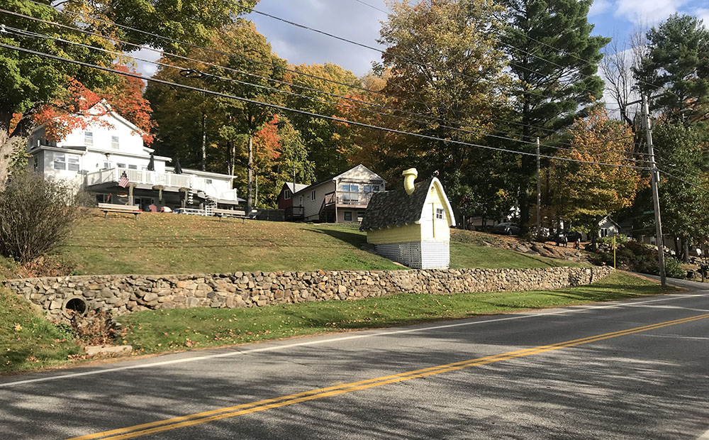
One hundred years later, little has changed. Scenic Weirs Boulevard, which was built in 1898, opened in 1899, and rebuilt in 1933, has been repaired and resurfaced many times since then, and is in very good condition, but it still twists and turns as it runs tightly along the eastern edge of Paugus Bay. The temptation to exceed the 35mph speed limit is high, leading some motorists to unwanted encounters with the men in blue.
Prior to 1899, travel from Laconia to Weirs Beach was “up and over the hills” via White Oaks Road. An April, 1894 petition called for “a new carriage road” following the shore along Long Bay (Lake Paugus) to the Weirs. However, the new road was not built for horse carriages. It was built for the electric trolley cars which ran to the Weirs from Laconia, beginning in the summer of 1899. It was several more years before the road was smoothed and made suitable for automobiles. Cars and trolleys both used Weirs Boulevard until trolley service ended in 1925.
Trolleys ran on the west side (Paugus Bay side) of the road. There was also a trolley siding in the area of Langley Cove. The Laconia city government approved construction of the boulevard in a vote on July 22, 1898. Eight contractors had bid on the project, and the Frederick R. Page company of Boston won with the lowest bid of $6,583. The trolley company pledged $3000 toward the expense of building the new road.
When first opened in 1899, the Laconia Democrat reported that “…many people inquire why a common highway, only hardly wide enough for two teams to pass, is called a boulevard. As a matter of fact the new road to the the Weirs is laid out seventy feet wide, but for financial reasons, only width enough to accommodate the electrics and make a passable road was put in shape at this time. In the future, when Laconia has a surplus in the treasury instead of a big debt, the road to the Weirs will be widened and made into a genuine boulevard.” Fast forward to the present, the road has never been widened to the extent as originally intended.
HISTORY OF SPINDLE POINT
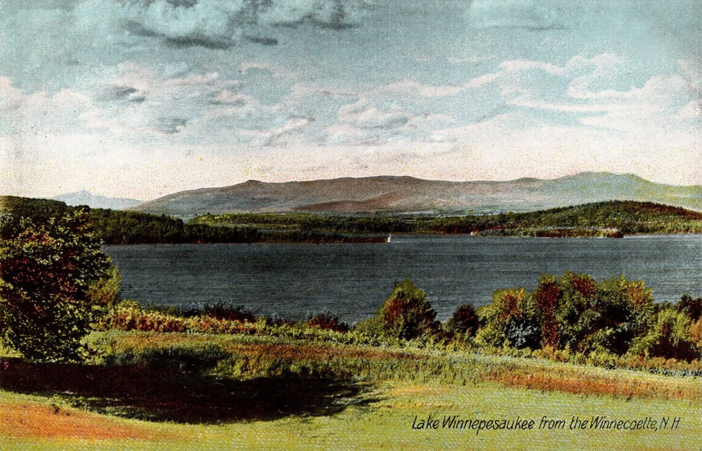
This old postcard (required postage 1¢!) shows Weirs Bay from the Winnecoette (later the location of the Shangri-La Motel, then the Brickyard Mountain Inn, and now the Village at Winnipesaukee condominiums). From left to right, one sees Mt. Chocorua off in the distance, Spindle Point, the Ossipee mountains, and Stonedam Island.
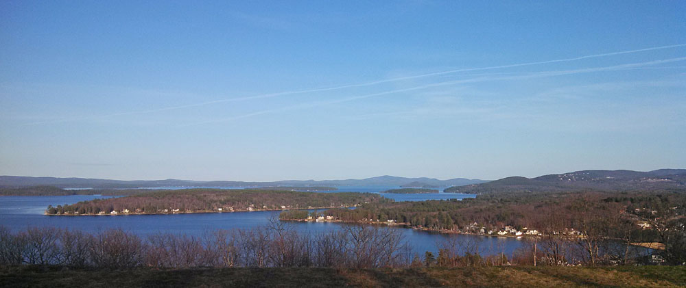
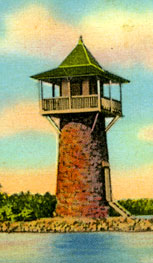
Spindle Point. The 40′ tall lighthouse at the very end of the narrow peninsula, built in 1892 by Colonel Charles H. Cummings for his daughter’s use as an observatory and art studio, was never used as a lighthouse. However, ever since its construction, it has become a landmark of Weirs Bay. Weirs Beach’s newest faux lighthouse, built in 2004, stands out prominently above the Meredith Bay (formerly known as Akwa Soleil) housing development on top of Weirs Beach’s Brickyard Mountain. It serves as a city water tower and cellular phone tower.
HISTORICAL POSTCARD MAPS OF LAKE WINNIPESAUKEE
HISTORY OF GAS PRICES
From a 1976 Weirs Chamber of Commerce brochure. The 1973 oil crisis had resulted in a quadrupling of gasoline prices by 1974. Clearly this was an area of concern at the time of this ad. Apparently, also at this time, 15 miles per gallon was considered “average” for cars. In 2012, even with a national average fuel economy approaching the upper-20’s for cars, gasoline prices are once again a major area of concern for visitors and the tourist industry.
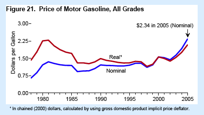
The first chart below shows that, while fuel prices increased 300%, from about 75¢ a gallon in the mid-70’s to about $2.25 a gallon in 2005, the real increase, adjusted for inflation, was from about $1.50 to about $2.00 a gallon – only about a 33% increase. Combined with an increase of 50% in gas mileage (from 15mpg to 22.5mpg in 2005), fuel costs actually decreased slightly since the 1970’s, calculated on the basis of “Miles Per Real Dollar” — 10 miles per real dollar in the 1970’s; 11.25 miles per real dollar in 2005.
