


Beach History
How old is the beach, and how has it changed over the years?
Prior to the 1950’s, Weirs Beach was known simply as “Weirs”, or more commonly, “the Weirs”, and in the popular language, this colloquialism continues to this day. The addition of the word “Beach” to the locale’s name was the marketing idea of a few savvy local businesspeople, especially Ed Hoagland, owner of the Lakeview House at the time. (It is still rare to find a town on the map anywhere in the USA today with the word beach attached to its name that is located on a lake, and not on the ocean!)
On November 17, 1955, by unanimous vote, the Laconia city council made the name change from “Weirs” to “Weirs Beach” official. Going along with the change was the B&M railroad. On April 12, 1956, the railroad ordered its local ticket agency to change the name of the Weirs train station to Weirs Beach station (the sign was actually changed on April 29.)
But the word “Beach” could not be added until there actually was a beach. Prior to the 1950’s, there was no beach at Weirs Beach. Bathers swam off the rocky shores of Endicott Park to a public raft.
The Public Raft
The public raft at the beach was built by the Weirs Business People’s Association during the last week of July in 1930 and was an integral part of the fun at Weirs Beach for the next two decades. The public raft was located right off the beach, near the Endicott Rock monument. Initially a flat raft, a small kiddie slide was added later. The water here was way too shallow for a diving board.


The Private Raft
The private raft was located right off of Irwin’s Winnipesaukee Gardens, near the speedboat and waterskiing dock. It featured a tall diving platform, and later, a low diving board facing the opposite direction from the platform. The water in this location was plenty deep enough for diving. In the first photo, swimmers contemplate a dive from the platform while the Miss Winnipesaukee speedboat passes by. The Mount Washington passes by in a following photo. The private raft was in use from the mid-1940s to the late 1950s.


A color linen postcard shows the Miss Winnipesaukee passing by the private raft. The second, black and white photo is the original photo and shows more detail.


A 1950s postcard shows the private raft moored at its usual location just a few feet away from the speedboat dock. The crowd is watching a speedboat race.

THE MINI BATHING BEACH
Back then, people didn’t go swimming – they went “bathing”.
The short and narrow strip of sand seen here was known as the Weirs Bathing Beach and was added around 1930. This was a big improvement over the previous, completely rocky shore, but nothing like today’s big, beautiful beach. The public raft and its short slide is shown.

Endicott Rock Bathing Beach paperweight.


The bathing beach, without the beauties.

The Uncle Sam cruises down the Weirs Channel in this postcard of the Endicott Rock Bathing Beach.

A relaxing day at the Endicott Rock Bathing Beach. The public raft is seen, lacking the slide that was added later.

“Mermaids at the Beach at the Weirs.” From a 1923-1925 Winnipesaukee Pier brochure.”…there is an added attraction, one that never fails to please, which consists of the bewitching assortment of girls, fair faced and fair of limb, who bathe their ravishing beauty in the sparkling waters of Lake Winnipesaukee during the summer.”

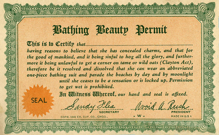
“Bathing Beauty Permit”. A humorous souvenir sold by the Half Moon Gift Shop in the 1940s.
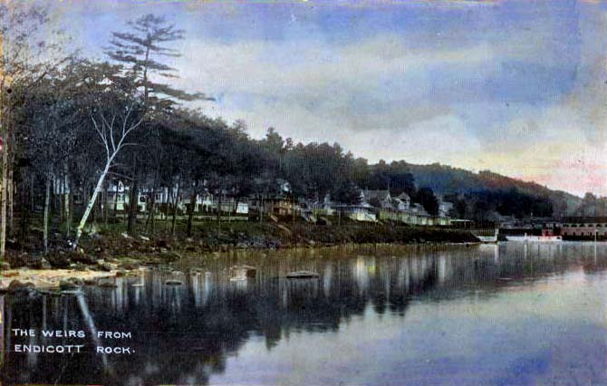
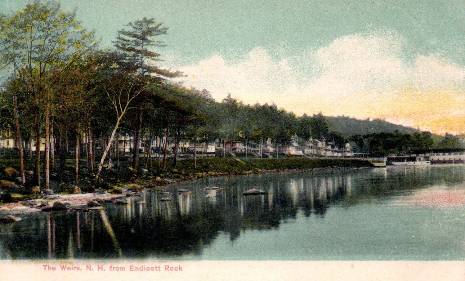
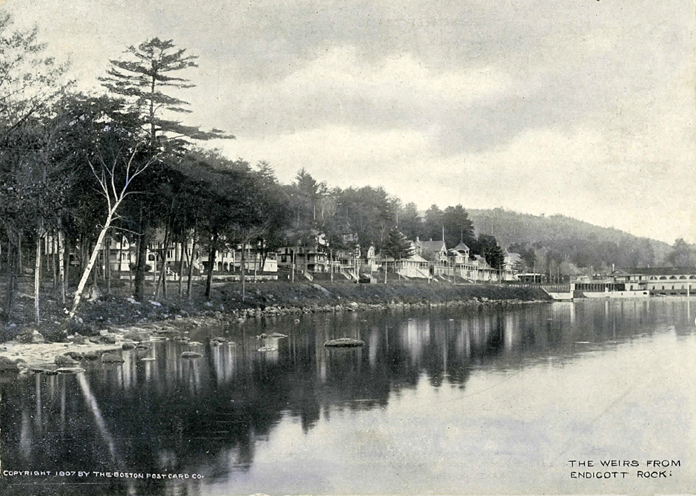
Endicott Rock Bathing Beach, The Weirs, Lake Winipesaukee, N.H.

WHEN THERE WAS NO BEACH

In the photo below, one of the three sets of railroad tracks which had been part of Lakeside Avenue since the mid 1880’s had been removed as far as the Cavalary HQ building and was in the process of being removed entirely.


Creation of the Beach
It was during the 1949-1951 administration of Laconia Mayor Thomas J. McIntyre that the beach was created. When McIntyre began his term as Laconia mayor on March 22, 1949, he was only 34 years old, the second-youngest mayor in Laconia history to that point. A Democrat, he was later elected Senator, and served NH for three terms in Congress, from November 7, 1962 – January 3, 1979.
A May, 1949 Laconia Citizen article noted that “…the Army Engineers had begun a survey of the Weirs Channel to determine the practicality of dredging. Currently, depth of the channel was five feet, which meant that it was too shallow for the Uncle Sam mailboat to pass through without dragging. A 12-foot channel was expected, and the fine sand taken out by the dredge could be used to make a beach from Endicott Park north along the shore.”
The Channel had to be dredged, and the feds were going to pay $25,000 to do it. The City jumped on the chance to build a beach with the sand from the dredgings. On July 13, 1950, the City Council voted to approve a $35,000, 20-year bond to pay for the beach. According to the Laconia Evening Citizen, “…the hope is to get back from the State the Endicott Rock park which the beach will adjoin…the long talked-of city beach at the Weirs is to be a reality sometime next month.”
Captain Edward Lavalle won the contract to dredge the channel. Lavalle was the long-time skipper and owner of the Uncle Sam mailboat.
An October, 1949 article in the Citizen noted that Lavallee had been awarded a contract of $24,820 for dredging the Weirs Channel. Work would start after completion of a 150-foot stone jetty extending from Endicott Rock. “Sand and gravel will be pumped from a 10-inch pipe and deposited along the retaining wall to lengthen the present bathing beach at Endicott Rock Park.” According to the article, the channel had last been dredged in 1929, “…and sand and gravel has since filled it in to a depth of three feet in spots.”
The first step was to build the jetty along the Weirs Channel to retain the new sand. According to a Laconia Evening Citizen article, “Construction on the jetty began on October 19, 1949, with arrival of the first load of granite grout from a Concord quarry. The jetty, extending 150 feet from the Endicott Rock into the lake alongside the channel, will require 485 tons of grout. The jetty will be 14 feet wide at the bottom, sloping to four feet at the top, and is expected to take about two weeks to complete.”
The 100-ton dredge barge was 45′ x 75′ in size when Lavallee purchased it in 1949 from the John Goodhue boatyard in Quincy, MA. Disassembled and moved in three sections, the barge arrived in Lakeport on December 9, 1949. After reassembly, the barge was launched into Paugus Bay on February 17, 1950. It barely fit through the Weirs Channel bridge, when it was moved later that spring to Weirs Bay to begin building the beach. Lavallee started dredging the Channel on May 6, 1950. Click here for a 1950 photo of the Weirs Channel dredge.
In late August, 1950, the Citizen reported that “…Captain Lavallee has had difficulty in securing sufficient sand which can be moved onto the new beach with the suction dredge. Mayor McIntyre admitted that Captain Lavallee might have to truck some bank sand in to complete the beach.” Truckload after truckload of extra sand was brought in from a Gilford sand pit.
1949 survey map of the Weirs Channel by the “Department of the Army, New England Division, Corps of Engineers, Waltham, Mass.”

Completion of the Beach – The Jetties
Two more long breakwater jetties were built to retain the sand. The two newer jetties divided the central part of the beach, and served with the original jetty, along the Weirs Channel, to keep the sand in place.
Below is an early 1950’s photo showing the second jetty in profile. (The Weirs Seaplane Base is viewed in the distance – note the roof of the building that is marked “FLY”.) At this time, the beach had only been built about halfway towards the Weirs Channel. An aerial photo from 1952 shows that the beach was being built from the opposite direction (from the Channel northward), leaving a gap in the middle, which is what we see in the foreground of the photo. The reason for the gap was that the northern, municipal section of the beach was owned by the City of Laconia while the southern, Endicott Rock Park section was owned by the state of NH.
The City had received title to the entire Weirs Beach waterfront in 1924 from the Boston & Maine railroad, but had deeded a section containing the Endicott Rock monument to the State in 1934. On June 3, 1952, the city purchased Endicott Rock Park back from the State, at a cost of $9000, with the State retaining only the monument itself. That summer of 1952, the City began building the southern side of the beach. But by late fall, there still remained a gap between the northern and southern sections.
According to a December 20, 1952 Citizen article, “Captain Edward Lavallee is piping sand from the channel to fill the short stretch of land between the two. Captain Lavallee constructed the municipal beach in 1950 with his suction dredge equipment. Captain Lavalle will move 1800 cubic yards of sand from the channel for $1 a yard.”
Sometime in the late 1970s, the two central jetties (simple structures made of iron rails, encased in wood, and weighted down with sandbags) were removed. A much longer and wider permanent cement and stone jetty replaced the third jetty along the Weirs channel.
Captain Lavallee died on January 24, 1984, at the age of 92. The beach he had built was a little over 30 years old at the time.


Before and After Photos
Compare the two aerial photos below to see Weirs Beach before and after the addition of the beach. The color aerial from 1960 shows the brand new, big, beautiful beach. The black and white aerial photo appeared in an ad sponsored by the Weirs Chamber of Commerce in a 1949 promotional brochure.


THE BREAKWATER
In May 1908 the Boston & Maine railroad donated the land for Endicott Rock park. This postcard was postmarked in 1911. Just beyond the steel bridge to the monument, a breakwater can be seen surrounding the swimming area. What looks like a breakwater down the middle of the channel was actually the 1800s dredgings, seen at very low lake water. In the black and white “Before” aerial above, we can still see the faint outlines of the swimming area breakwater, 40 years later.

Erosion Takes Its Toll
Only 8 years after its initial construction, erosion had already taken its toll. A May 1958 Laconia Citizen article noted that work was about to start on a project to reclaim “about 2,000 cubic yards of sand which have washed away from Endicott Beach at The Weirs.” During the 1960s, the beach was continually replenished with new sand every year or two. The last replenishment occured in 1969. Since 1970, no new sand has been added to the beach.
As is clear in the photo below, in the 1960s, the beach originally extended via a narrow strip all the way to the public docks. Mother nature and the forces of erosion have taken their toll over the intervening 40+ years; today, the beach does not even extend as far north as the second set of stairs that used to lead to the beach from the public boardwalk.

Eventually, all the sand at the north end of the beach migrated south, towards the channel. The result is the wide, beautiful crescent beach of today. The southern end of the beach, where most of the sand has piled up against the long breakwater jetty along the Weirs Channel, is nicer than ever. But the northern end of the beach is now completely gone. Compare the “Then” and “Now” photos below. (The “Now” photo is out-of-date. The beach has eroded even further than this 1998 photo.)


In May, 2011, the latest effort to restore the beach to its previous extents (there were two earlier efforts) began with the hiring of the Woods Hole Group of Plymouth, MA to study the erosion problem. This latest restoration effort has continued to this very day.