


Swimming
When is the best time to go to the beach?
The best time to go SWIMMING is from the end of June through the end of August, when the water temperature is in the 70ºs—cool, clear and refreshing. In late May, early June, and September, water temperature is in the 60ºs —brisk and invigorating for a short dip. From October through April, water temperature is in the 50ºs or lower—time to put away the bathing suit. To see a typical summer’s worth of water temperature data, click here.
You can check the current water temperature at Weirs Beach, from the State of NH’s Lake Winnipesaukee monitoring station, by clicking here. Find the Lake Winnipesaukee monitoring station by moving your cursor over the triangles on the NH map. Click on the Lake Winnipesaukee triangle. Then, find the drop-down marked “Observed Reservoir Pool Elevation”. Change the drop-down to “Water Temperature”. You will see a graph with a month’s worth of lake temperatures. To see today’s water temperature, move your cursor until it is over the last dot in the graph. Or, click on “Table”, then click on “Last Page”, to see the current temperature.
The monitoring station is located at the near end of the Weirs Beach public docks, near the Mount Washington cruise ship. Below is a photo of the Sutron sensor, which uploads the data every hour.

Previously, the State of New Hampshire’s Department of Environmental Services (NHDES) monitored the water quality of the beach at three different locations to make sure that it was safe for swimming. The department used to set up a Beach Monitoring Station at Weirs Beach, and a website where the results were reported. The sampling was done on an hourly basis, and through the use of satellite telemetry, showed results in real time.
Since 2020, that is no longer the case. Now, the City of Laconia’s Parks & Rec department staff sample the beach, and only once per month. The only way to know now if there is an advisory posted at Weirs Beach is to call the Parks & Rec department at 603-524-5046, or to go to the beach and see for yourself. When there is an advisory, signs are posted at the entrance. If the beach is closed, it is usually only closed for a day or two. Longer term closures are rare. The NH DES’s “Healthy Swimming Mapper” website is still active, but the only nearby beaches shown on the map are the Meredith and Gilford town beaches (checked monthly), and the state-owned beach at Ellacoya (checked twice a month).


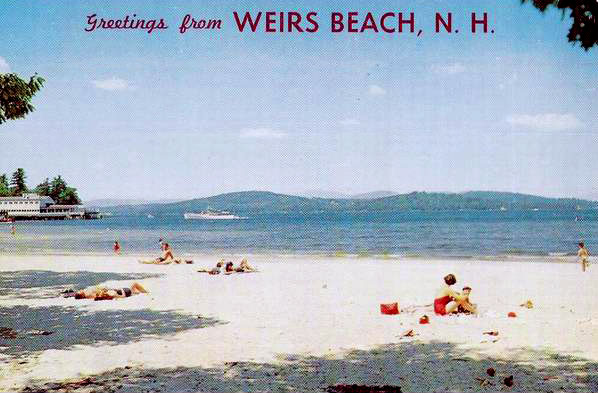
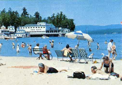
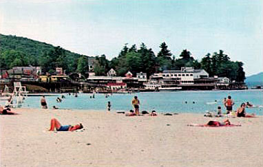
HISTORIC BEACH PHOTOS
In this circa 1958 photo, the public docks have not yet been extended South past the footbridge. Note the little shack at the bottom of the stairs to the beach – purpose unknown.


An early 1950’s photo showing the little shack.

Beautiful 1960’s beach scenes, showing the Mount departing Weirs Beach.


At the center of the photo is the boulder at Interlaken Park from where many pictures where taken of Weirs Beach from the 1900’s through the 1940’s.

A view around 1960, looking towards the boardwalk. The current bathhouse had not been built yet.

Another 1960’s beach scene.

More postcards of beautiful Weirs Beach.

Circa 1960 beach scene. A close look below seems to show the middle portion of the beach under water. This was the last portion of the beach to be built.

Postcard of Weirs Beach from the early 1950’s. Part of this image is used for the logo atop the series of historical signs on the Weirs Beach boardwalk.

An early 1950s photo of Weirs Beach.

Linen postcard from the early 1950’s. Note the roof of the Endicott Rock Monument, off in the distance in the background of the photo, which has been mistakenly colorized red. The roof has always been natural unpainted stone. Also one can see that the beach does not extend as far as the monument. In the early 1950’s when the beach was first created, and when this photo was taken, the beach had only been half built, starting from the north end, nearest the public docks. Fairly wide at the time, it was only a few years before erosion narrowed the north end of the beach, moving most of the beach sand south towards the Weirs Channel end of the beach. Click here to see a 1952 aerial photo of the half-built beach.

The Weirs Channel end of the beach in the mid 1950s.

For your amusement, here is another old linen postcard, postmarked in 1947. The caption notwithstanding, the photo is NOT of Weirs Beach! Notice the ocean in the background. Somebody didn’t do their homework.

Baby crib at the beach, 1960s

Other Swimming Beaches
If you’d like to try swimming at a different beach than Weirs Beach, there are two other beaches in the area that are big and beautiful and open to the general public. They are Ellacoya State Park, on Lake Winnipesaukee in Gilford, and Wellington State Park, on Newfound Lake in Bristol.
There are quite a few smaller municipal beaches in the area. Most are only open to town residents. Typically, resident restrictions are enforced at the beach parking lot, where a resident sticker must be displayed. In Laconia, besides Weirs Beach, there are FIVE other beachs: two beaches at Opechee Park (Opechee Cove and Opechee Point) and Bond Beach, on Lake Opechee; Bartlett Beach, on Lake Winnisquam, and a beach at Ahern State Park, also on Lake Winnisquam. Meredith has Leavitt Beach (see below), on Lake Winnipesaukee, and Waukewan Beach, on Lake Waukewan. Belmont has the Leslie E. Roberts Beach on Lake Winnisquam. Gilford has its Town Beach on Lake Winnipesaukee. There are many other town beaches all around the big Lake, click here for a comprehensive list. If you are not a town resident, your best bet is to visit the town beach in the off-season, after Labor Day, when town parking restrictions are rarely enforced.
Finally, there are private beaches scattered here and there amongst the many bodies of water in the Lakes Region of NH. Count yourself one of the lucky few if you have friends or relatives to visit who have private beach access.
Leavitt Beach in Meredith, September 9, 2025.
