Revitalization
How many Weirs Beach revitalization plans have been issued?
At last count, there have been seven plans to revitalize Weirs Beach. Revitalization plans were issued in 1940, 1947, 1966, 1979, 1998, 2007, and in 2016.
1940’s Plans
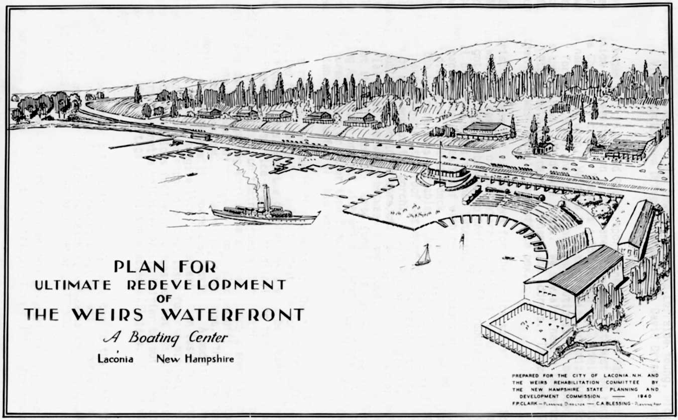
After the depression of the 1930′s, with the Golden Era of Weirs Beach long over, and the few buildings being built in the interim with little architectural significance, the first of many revitalization plans for the core area of Weirs Beach was created in 1940. Called the “Plan for Ultimate Redevelopment of the Weirs Waterfront“, the plan was prepared for the City of Laconia and the Weirs Rehabilitation Committee by the New Hampshire State Planning and Development Commission, F. P. Clark, Planning Director, and C.A. Blessing, Planner.
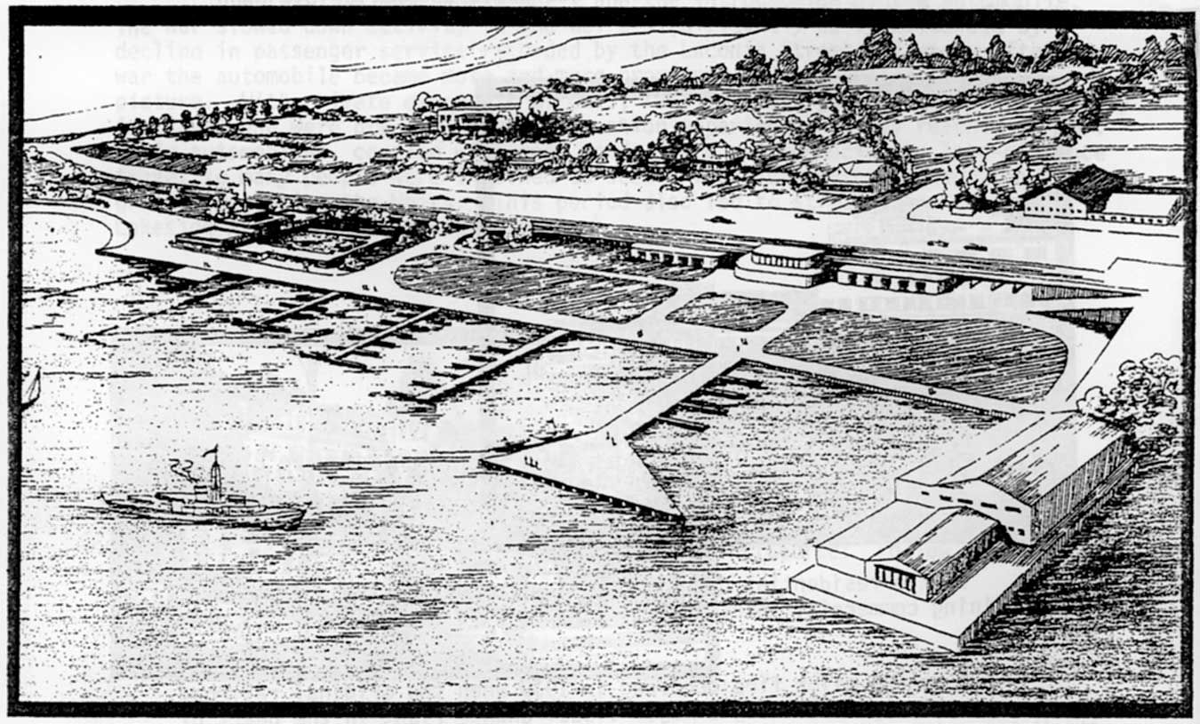
The next revitalization plan that stepped up to the plate was created in 1947. Called “A Suggested Plan for the Redevelopment of the Weirs, N.H.“, it was once again prepared for the City of Laconia by the New Hampshire State Planning and Development Commission. It was little more than a variation of the 1940 plan, with the street side of Lakeside Avenue remaining mostly as it was, and a massive expansion planned for the waterfront.
In this case rather than an amphitheatre, the dominating feature of the plan was a huge, triangular shaped pier, protruding beyond three large enclosures of water. However, this plan did call for a convention center up on the hillside (the tall, rectangular building in the upper part of the drawing, slightly left of center) and, directly across from the convention center on the water , a large bathing facility facing north to a swimming pool surrounded by a deck on 3 sides.
Both the 1940 plan and the 1947 plan addressed the need to significantly expand the public docks, which in 1947, had yet to be rebuilt following the 1939 fire which had destroyed the train station, original steamship Mount Washington, and the public wharf. By the time of the next revitalization plan in 1966, this goal had already been accomplished, although certainly not in the way the 1940 and 1947 plans had envisioned.
1966 Plan
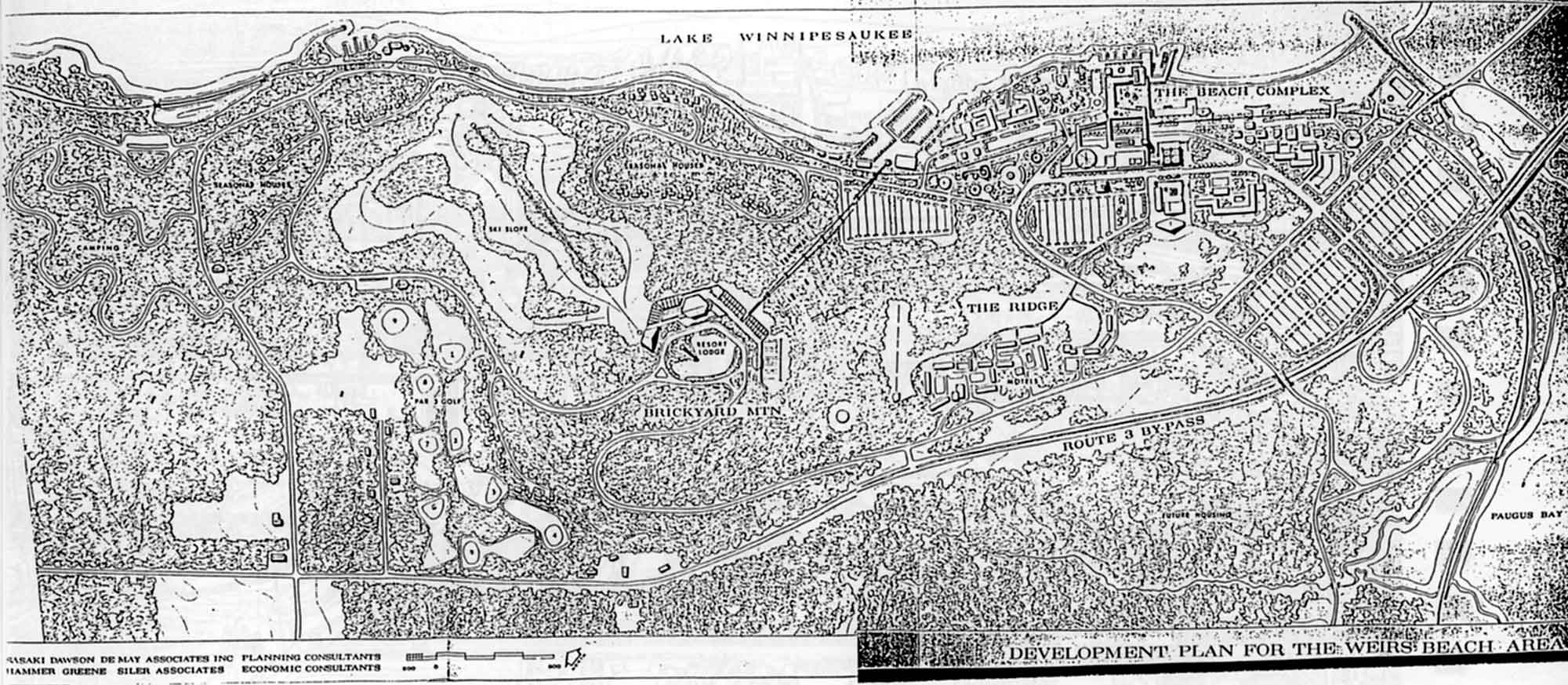
The 1966 revitalization plan was titled “Proposed Development Plan for Weirs Beach” and was prepared for the city of Laconia by a Massachusetts consulting firm – Sasaki, Dawson and Demay Associates.
Downtown Laconia, before “Urban Renewal”, was bustling and vibrant with activity. Click here to see many other historical looks at downtown Laconia – before Urban Renewal.
Similar to the Laconia urban renewal plan, the 1966 plan called for not only new buildings, but also a radically revised traffic pattern, complete with new roads and parking lots. A mega parking lot would replace the Weirs Beach Drive-in and extend North as far as Hilliard Road; a Route 3 bypass would be constructed across a new bridge across the Weirs Channel, plowing through Channel Marine and reconnecting to Route 3 in the area of today’s Cedar Lodge; and two new streets would slice diagonally down Tower Hill to connect with the core and Scenic Rd in a circular pattern.
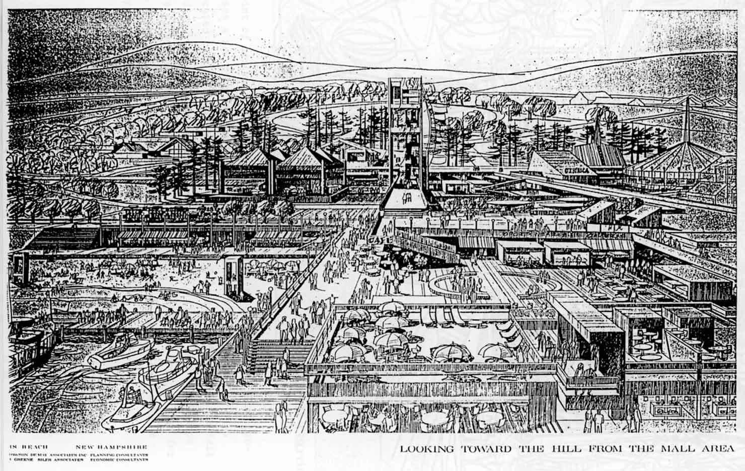
Sounding more and more like a Disney-type development, Lakeside Avenue would become a pedestrian mall, with visitors conveyed by “gaily designed old-time vehicles shuttling between [parking lots] and principal activity areas”; the core would be rebuilt with a new cruise pier and “Tivoli Gardens” area (Tivoli Gardens, in Copenhagen, Denmark, is the world’s oldest amusement park); and, like the 1940 revitalization plan, an amphitheatre (diamond shape at the center of the circular traffic pattern on the map) would be constructed, with seating for “500 or more.”
To put this plan in context, in 1966, NH’s interstate highway, Route 93, was less than a decade old, having been formed in 1957. When Exit 20 in Tilton was first constructed, a 3-phase plan was proposed by the New Hampshire Department of Public Works and Highways, whereby the exit would be connected by a divided highway directly to Weirs Beach!
In phase one, a bypass highway would be built around Laconia. Two routes were studied in 1959. The first, an 8.9 mile “internal” route, would have paralleled the railroad from Veterans Square to Lakeport, and continued to parallel the railroad alongside the western shore of Paugus Bay. Just before Weirs Beach, the internal route would have diverged northwest through woods, to join up with Route 3 at the Laconia-Meredith town line. The second, 10.6 mile “external” route”, the “Laconia-Gilford Bypass”, became the preferred alternative. Construction began in 1963. The Bypass was officially opened to traffic on October 15, 1968.
In phase two, the Laconia bypass would have been connected directly to Route 93, relocating twelve miles of Routes 3 and 11. At a public hearing on May 21, 1969, two routes were proposed for phase two. Both routes would have started from Interstate 93 about a mile north of the Exit 20/Tilton interexchange. The cost was estimated at $6-$8 million. The northern route “…would remain north of Route 3 and intersect with the Lancaster Hill Road and Perkins Road and cross Winnisquam on a new bridge to be built next to the present Mosquito bridge, would cover 6.4 miles, have five interchanges, and displace 177 homes and 10 businesses. The southern route “…would cross Route 3 in Lochmere north of Silver Lake and run south of Lake Winnisquam, intersecting Union Road at two points, would have four interchanges and would displace 15 homes and 5 businesses. The Mosquito bridge would be rebuilt or replaced.”
While the NH DPWH (renamed in 1986 the NH Department of Transportation) and federal DOT highway officials seriously studied this “Franklin-Laconia Bypass” second phase for nearly 30 years, and while it was supported by many Laconia businesses and officials, it was opposed by the towns of Belmont and Tilton, who filed suit in US District Court in Concord in early May of 1983 to stop it. Even though the proposed highway would have passed through the environmentally sensitive Lake Winnisquam and Silver Lake watersheds, the towns did not sue on this basis. Rather, the towns sued on the grounds that the highway would cause “irreparable harm” to the 8,000-year-old Lochmere Archeological District, which had just been established in 1982. In late August, 1983, the towns won their suit.
The federal DOT appealed the district courts’s ruling. In Boston, on July 27, 1985, Judge Stephen G. Breyer of the First Circuit Court of Appeals (later to be a US Supreme Court Justice), made his decision in the case of Town of Belmont et al. v. Elizabeth Dole, US Secretary of Transportation. He overturned the lower court’s injunction against the highway project, agreeing with the DOT that in some cases, archeological recovery was a better option than historical preservation. But it was too late. The project was already dead. John H. Sununu, governor of NH from 1983-1989, had removed the project from the State’s 10-Year plan.
With the second phase out of the picture, the 3rd phase, which would have extended the Laconia bypass from Lily Pond down the White Oaks Road corridor to the junction of Route 3 and Route 11B in Weirs Beach, and built a new bridge over the Weirs Channel, died a very quite death in the 1990s when rights-of-way the NH DOT had acquired in the 1960′s formally expired. A February, 1974 Laconia Citizen article noted that, with construction costs of $4.4 to $6 million, plus land acquisition costs in the millions, “Chances for completion of the Laconia Bypass from Lily Pond to the Weirs within the foreseeable future were ‘practically nil’ according to the New Hampshire Highway Department.”
The authors of the 1966 plan fully expected Weirs Beach to be directly connected to the interstate highway system by the end of 1970′s, so their exuberance is understandable.
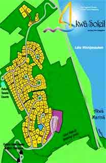
Interestingly, only the plan’s proposals concerning Brickyard Mountain seem close to being realized. The plan envisioned a “quality mountain-top resort complex with a complete range of physically integrated facilities, including 200 or more seasonal homes.” Meredith Bay (previously known as Akwa Soleil) has built such a housing development, a 171-home gated community called Akwa Vista, on 140 acres atop the mountain. The Akwa Marina complex, just north of Doe Point, has a large parking lot across Scenic Road, similar to that seen on the 1966 plan map. Planned for future expansion is the Akwa Verdant subdivision, on 215 acres west of Route 3 from Akwa Vista, which will, if built, feature a golf course, also seen on the 1966 plan map.
A 1976 article titled “Indian Fishing Ground Turned Pinball Paradise” explains in depth why the 1966 plan failed. This very interesting article includes quotes from key Weirs Beach businessmen of the 1970’s including Sidney Ames, Bob Lawton, Jim Irwin, and George Abdulla, and is highly recommended reading.
1979 Plan
The next revitalization plan for Weirs Beach was created in 1979 for the Lakes Region Planning Commission by Russell Thibeault of Applied Economic Research in Laconia and the W.M. Design Group, and was titled simply the “Weirs Investment Plan“.
Like the 1966 plan, the 1979 plan proposed the creation of more parking lots and 2 new roads slicing diagonally down Tower Hill to interconnect them in a loop. However, the 1979 plan was far less radical than the 1966 plan, because the new roads and parking would supplement the exisiting roads and parking, rather than completely replace them. Also like the 1966 plan, the 1979 plan envisioned a trolley shuttling visitors from fringe parking areas to the core; and the development of the marina and parking lot at the base of Brickyard Mountain, as seems about to occur with the Akwa Marina project.
Like the 1940 and 1947 plans, the 1979 plan proposed expanding the public docks significantly, in this case bridging the gap between the existing Winnipesaukee Pier and existing public docks with a huge wharf.
Like the 1940 and 1966 plans, the 1979 plan proposed the creation of an amphitheatre; in this case the stucture was proposed for placement in the historic Veteran’s Grove, rather than on the waterfront (1940 plan) or central core (1966 plan).
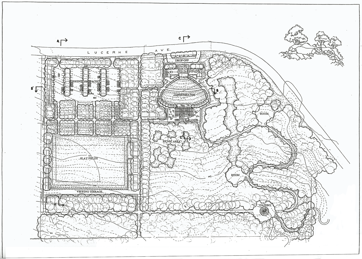
The idea of an amphitheatre in Weirs Beach is an idea that seems to just keep going and going, although the proposed location of the amphitheatre is forever changing. There is now a public amphitheater in Weirs Beach, but it is a very small facility, located far from the core, in the Weirs Community Park, located on Lucerne Avenue. This city property, acquired in 1979 with funding from the federal Land and Water Conservation act, also has a trail system, picnic area, and playground, but no playing fields. (The Weirs Community Park was built in 2013, on the land of the former Camp Acadia.)
One of the new ideas in the 1979 plan was a proposal for commercial development across the Weirs Channel from Endicott Rock. Although the proposed pedestrian bridge across the channel was never built, the site was developed commercially; built by the Dexter Shoe corporation in the 1980′s, the site is now the Alpenrose Plaza, housing the Weirs Beach post office, a restaurant, and an arcade, as well as several smaller businesses.
The 1979 plan was very cognizant of the need to protect the historical legacy of Weirs Beach; it proposed an Indian museum and a Veteran’s museum, and historical designation for the Veteran’s property. In 1980, the New Hampshire Veteran’s Association Historic District was created, and listed with the National Register of Historic Places. Neither a Veteran’s museum nor an Indian museum has been built yet; however in 2004, Weirs Beach’s first museum, the Lake Winnipesaukee Historical Society museum on Route 3, began operations.
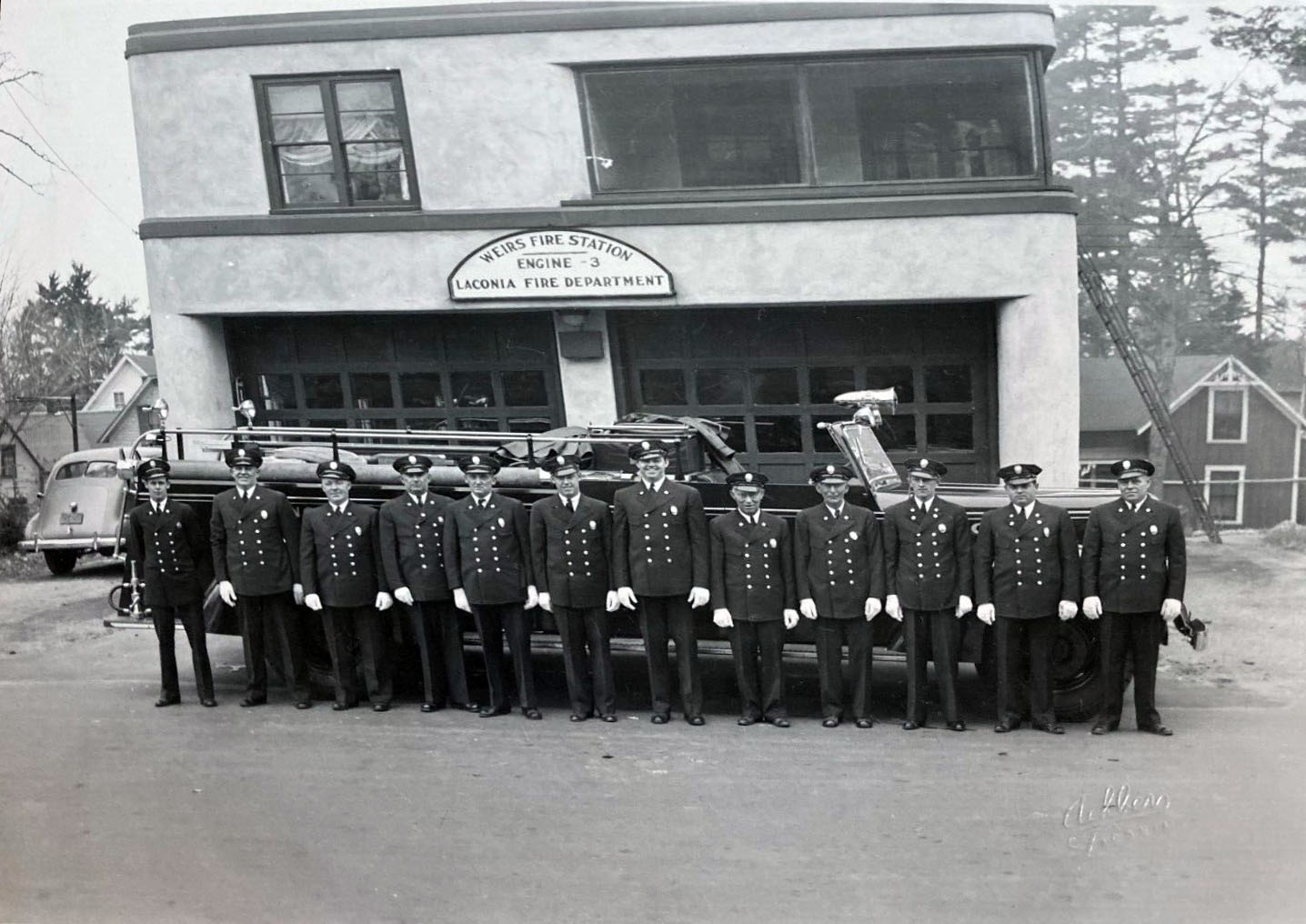
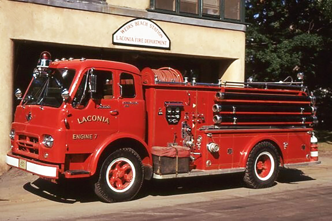
The 1979 plan recommended that the fire station, which had previously been located on Lakeside Avenue, be relocated to the intersection of Route 3 and Warner Street, to take it “out of the very congested area on Lakeside Avenue and put it in an area where it could more easily service many potential danger points”. In 1984, the fire station was relocated from its under-sized 1936 home on Lakeside Avenue (an “Adobe Pueblo” building with stucco exterior and softly rounded corners); but the relocation was to the corner of Lucerne Avenue and Route 11B.
The 1979 plan recommended “consistent graphics treatment of signage within Weirs Beach”. While some businesses have made a voluntary effort to make theirs signs reflect Weirs Beach’s Victorian heritage, others have not. The recent proliferation of electronic signboards on the short stretch of Route 3 at the entrance to Weirs Beach (by last count, there were 4 such signs) is very unfortunate and does not enhance the attractiveness of the area in any way. The 1979 plan’s call for a historic district ordinance and/or a Design Review Board may be more needed than ever.
Finally, the 1979 plan pointed out the need for “revitalization of building facades and rehabilitation of many of the fine historic buildings.” In the year 2006, the Half Moon, which spans the central block at Weirs Beach’s core, completed a 4 year effort to replace its facade. New signage, overhead canopies, columns, cupolas, and reconfigured entranceways, greatly improved the facade. Meanwhile, the Veteran’s Association has continued to rehabilitate its buildings with new roofs, new stairways, and new paint jobs.
In 1992, to fend off an effort by a part of the Weirs Beach populace to secede from the City of Laconia, a committee was formed to study 56 grievances listed by the Weirs secessionists. The committee’s recommendations for revitalization included “traffic circulation, off-street parking, unifying the theme of the area and upgrading the image of Weirs Beach through aesthetic improvements and a broadening of the variety of activities it provides.” The secession effort later failed in the State legislature. Paul Fitzgerald, mayor of Laconia at that time, successfully fought off the effort. He later commented, “I was astounded how far down the tracks (the effort) had gotten. It was a well-oiled, well-maintained machine with a talented lobbyist. They distributed materials, their arguments were in place…about how evil the City was and how badly it mistreated the Weirs. It took a great deal of effort…but we came back from the brink.” (Laconia Daily Sun, Feb 22, 2018)
1998 Plan
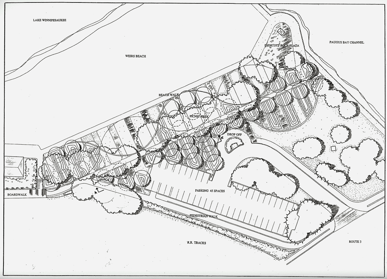
In 1998, another revitalization plan, Revitalizing Weirs Beach Through Recreation, was written by Kyle J. St. Germaine, and was his master’s thesis for a degree in Landscape Architecture. The plan was developed with significant input from the City of Laconia’s Planning and Parks and Recreation departments. Revitalization would be accomplished by developing the Weirs Community Park, redesigning and improving Endicott Rock Park, and by creating a “connective vehicular and pedestrian system which would link the parks in the Weirs” and act as a “distinct gateway” to the area. Included was a proposal to retrofit the Weirs Channel bridge with a suspended pedestrian walkway that would be cantilevered off the north side of the bridge!
2007 Plan
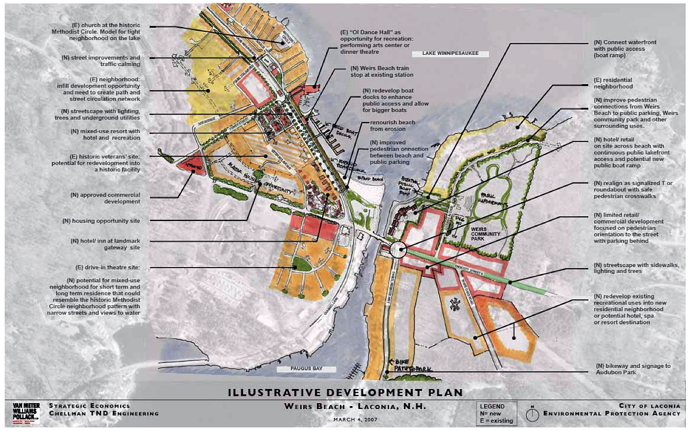
The next-to-last revitalization plan, Smart Growth Implementation Assistance for Laconia, New Hampshire, was written by a team of consultants coordinated by the U.S. EPA (Environmental Protection Agency) and ICF International of Minneapolis, MN. The consultant team included firms from Berkeley, CA; San Francisco, CA; and Portsmouth, NH. The plan, dated November 1, 2007, was publicly presented to the Laconia City Council on January 28, 2008. The plan included revitalization ideas not only for Weirs Beach, but for Lakeport and downtown Laconia as well.
The Weirs Beach part of the plan focused in on four key areas: “circulation improvements, waterfront enhancements, refined zoning, and gateway development”.
Among the suggested circulation improvements was a redesigned intersection of Route 3 and Route 11B, either as a “T” with traffic lights, or as a rotary; a pedestrian/bike bridge over the Weirs Channel; and improved sidewalks radiating in all directions from the route 3 – Route 11B intersection. The intersection, known locally as “Malfunction Junction”, was finally funded for replacement by the NH DOT in 2010. The new rotary constructed in the spring and fall of 2012 (construction was suspended during the summer months) and completed in the spring of 2013.
Returning to the 2007 plan: the key waterfront enhancement would be a public boat ramp on the east side of the Weirs Channel, accessible either from a possible future private hotel/retail development along the Channel, and/or directly from Lucern Avenue. Additionally, stormwater runoff reductions are urged in order to reduce erosion to the public beach; and reconfiguration of the public docks to increase the overall number of spaces, as well as to allow for bigger boats, is suggested.
Refined zoning, as defined by the plan, would redirect development of Weirs Beach away from commercial uses, and instead drive development toward more year-round, residential uses, such as a “small scale, compact mixed-use development with a mix of residential types, narrow streets, and views of the water.”
Finally, the plan emphasizes “gateway development”. As the plan explains, a gateway is “an entrance or access point to a community, usually signaling a change in landscape.” Clearly, the intersection of Route 3 and Lakeside Avenue, where the Weirs Beach sign is strategically placed, is the gateway to Weirs Beach, as the landscape does change dramatically once one enters Lakeside Avenue from Route 3.
The plan would enhance the attractiveness of this gateway by replacing the Weirs Beach Waterslide/Volcano Mini-Golf with a new “anchor” – a higher-end, year-round resort hotel. The plan mentions several other “fine” locations where such a hotel could be appropriately located, including along the Weirs Channel; on White Oaks Road; on the NH Veterans property; and on the current site of the Half Moon. However, the waterslide would seem to be the most logical year-round location, as it would be highly visible both to summer visitors on Lakeside Avenue, and winter visitors along heavily trafficked Route 3. (The waterslide and mini-golf course were removed in 2014 and replaced with the Boardwalk Bar & Grill in 2017.)
2016 Plan
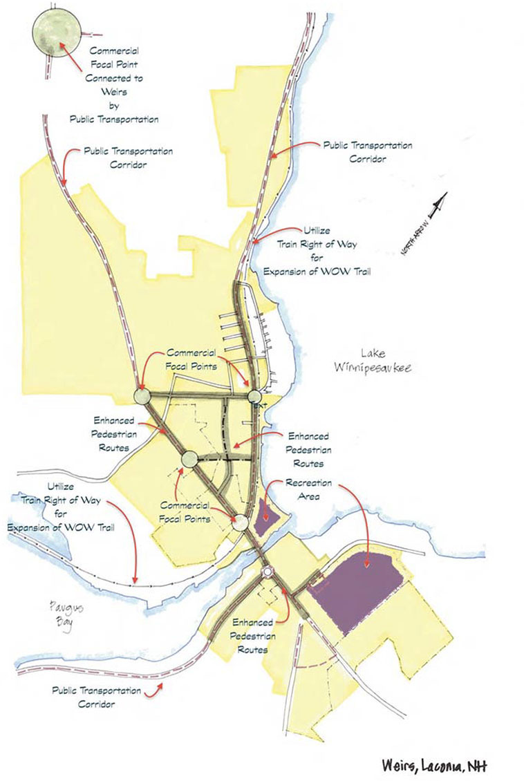
The most recent revitalization plan, “Re-Imagine Laconia” was written by Plan NH in conjunction with the City Planning board, and addressed revitalization needs in downtown Laconia and in Lakeport, as well as in Weirs Beach. A design charrette was held at the Weirs Community Center on November 19, 2015, soliciting input from the community, and the plan was published in January of 2016. Among the key suggestions were the following:
1) Greatly improve pedestrian and bicycle access. New paths, from the boardwalk/Lakeside Ave to Route 3, and alongside Veterans Avenue, would encourage pedestrian activity in the core, by avoiding high traffic areas. New sidewalks would be built on Weirs Boulevard, and on the opposite sides of Route 3 and 11B, where there are currently no sidewalks. The WOW multi-use recreational trail would be built out in both directions, towards Lakeport and towards Meredith.
2) A large outdoor canopy. The canopy would be built in one of the many vacant lots on Route 3, lots that are currently used for parking and Motorcycle Week vending. The canopy would be used for events like flea and farmers markets and other events, and for bicycle rentals.
3) Like many previous plans, a large hotel, a boat ramp, and a coffee shop are hoped-for amenities that would contribute to revitalization.
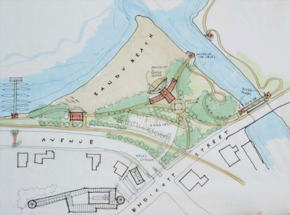
In an earlier draft, the 2016 Plan NH plan had included the following “Weirs Gateway” sketch of the beach area. Reminiscent of St. Germaine’s 1998 plan for Endicott Rock Park (see above), the plan would add a a suspended pedestrian walkway cantilevered off the north side of the Weirs Channel bridge, where it would connect with an ADA accessible pathway down to the Channel. The Endicott Rock stone and monument would be relocated to the center of the Park, where it would connect with an amphitheater pavilion and shade plaza; and two gazebos would be added to opposite sides of the channel at the “mouth of the Weirs”.
Plan Summary
The many revitalization plans have reflected a public impatience with the pace of change at Weirs Beach. While there have been many improvements over the years, they have come at a measured – and some might even say slow – pace. The reason for the slow pace is clear. Weirs Beach has been, is, and will remain primarily a summer resort, with a 10-week peak season extending from the last week of June until Labor day. Due to the shortness of its season, the amount of funds available for investment will always be considerably less than would be available if Weirs Beach were a solid 3-season tourist attraction or a lively year-round residential location.
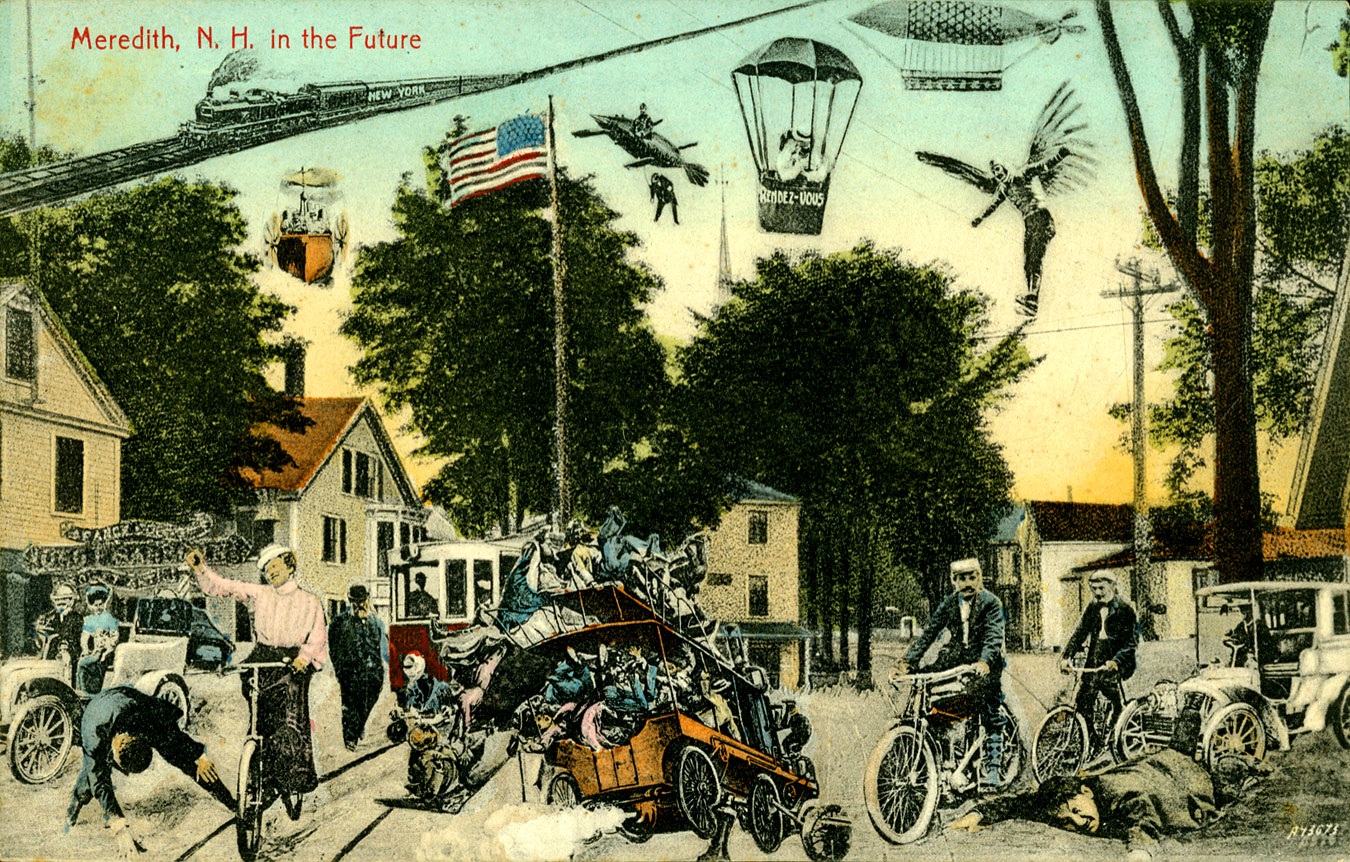
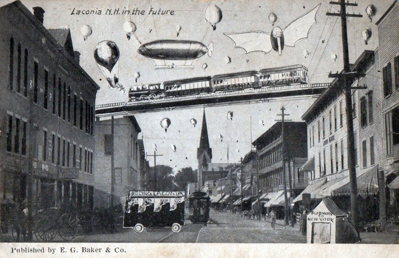
“IN THE FUTURE” POSTCARDS
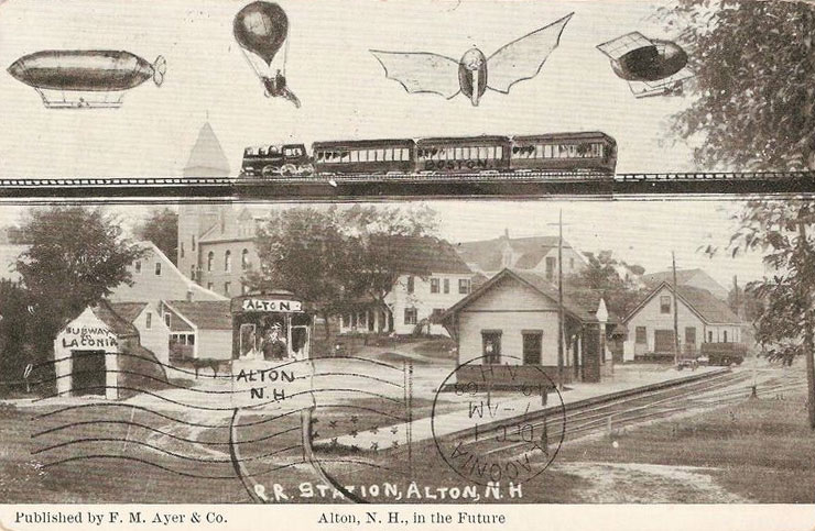
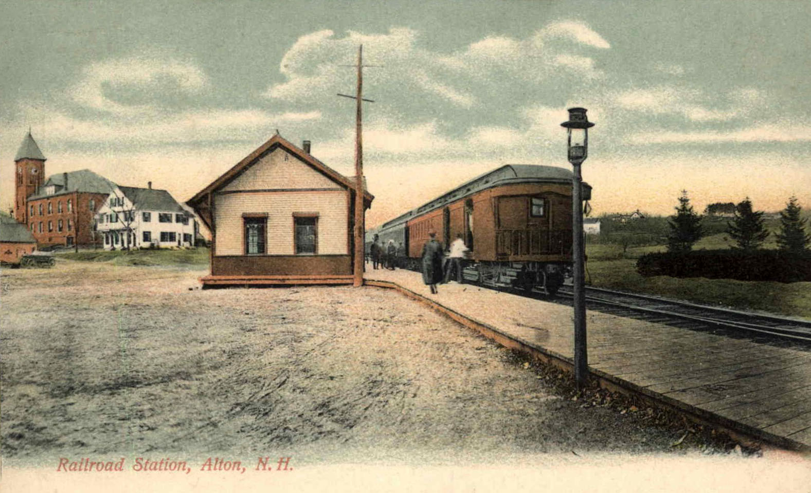
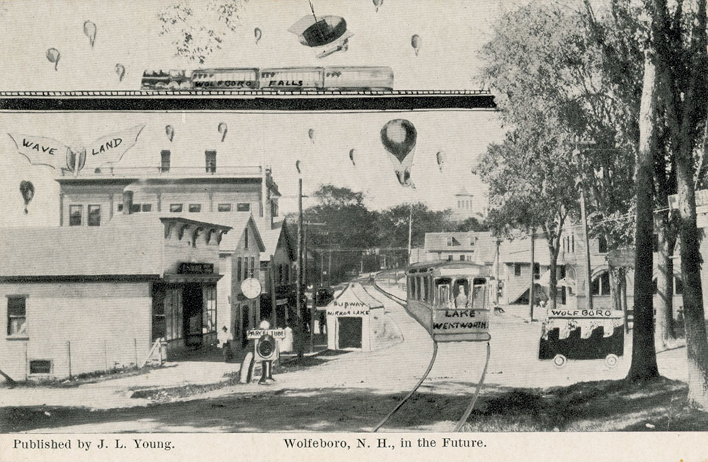
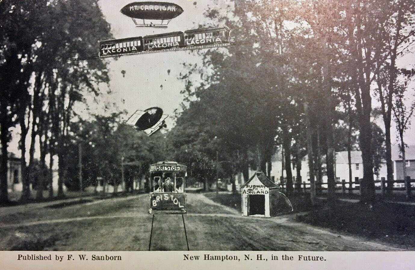
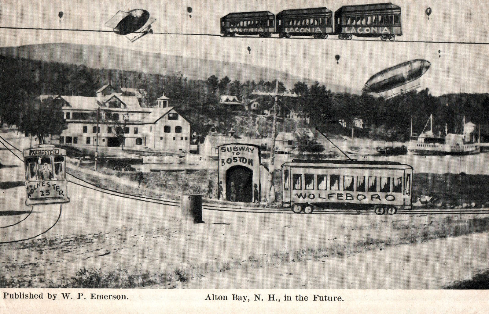
Dreams of the Future of Alton. Postmarked in 1908. The future in Alton was conceived to offer overhead monorail transportation; and a variety of modes of transportation by air, including a zeppelin, a hot air balloon, a flapping wing aircraft, and a flying egg! But the artist seems to have lacked imagination regarding ground transportation. Where are all the cars? Apparently not needed, as one can travel by train or streetcar, or take a “Subway to Laconia”!. (A different “In the Future” card was made for Alton Bay and can be seen here (scroll down).)
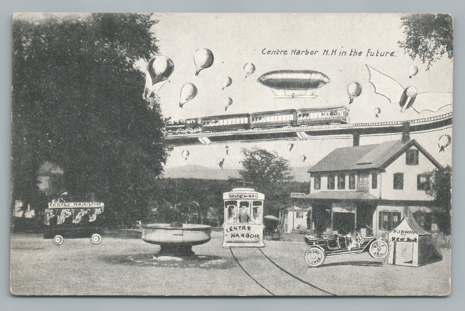
Dreams of the Future of Centre Harbor. Future transport in Centre Harbor was to include hot air balloons, a zeppelin, a flapping wing aircraft, a street railway, an overhead railroad, a passenger van, and as in Laconia, a subway to New York, on which a car was leaning precariously. The Kona Fountain, at the center of the postcard, is still there. The fountain was dedicated in 1907 and restored in 1997.


