


Lake Winnipesaukee Photo Tour #2
Greetings From Lake Winnipesaukee (#2)

Multiview postcard published circa 1960 by Bromley & Co. Version number two of two different versions of the card that were published. The photo numbers below correspond with the above postcard.
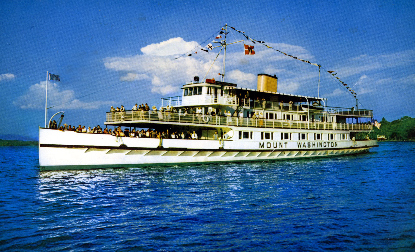
#1 The Motor Vessel Mount Washington
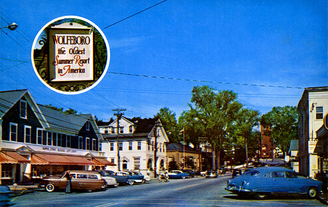
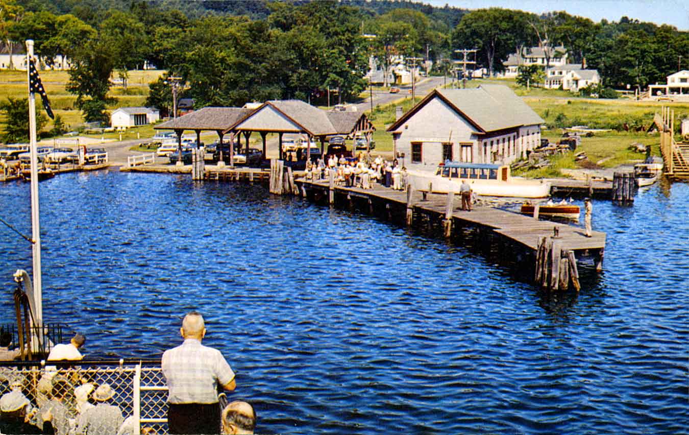
#2 In Downtown Wolfeboro
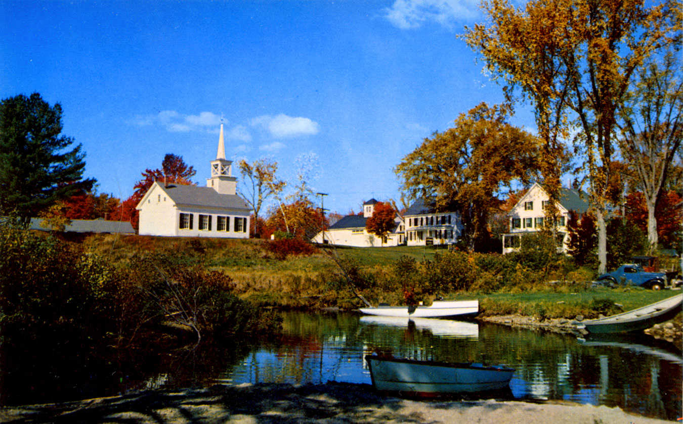
#3 Melvin Village
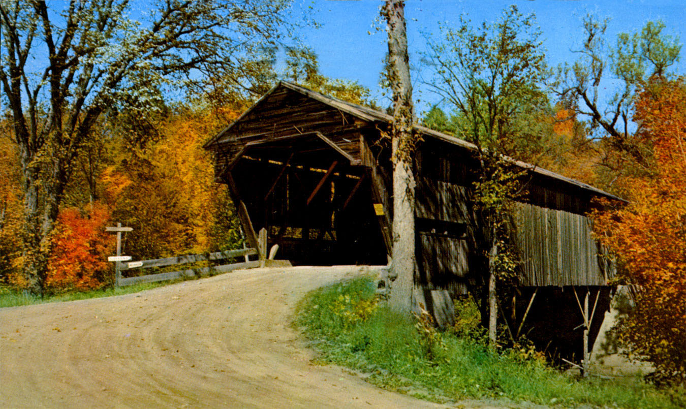
#4 Durgin Bridge, Sandwich
#5 Approaching Center Harbor
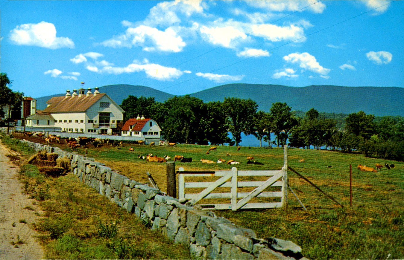
#6 Red Hill from Dane Farm
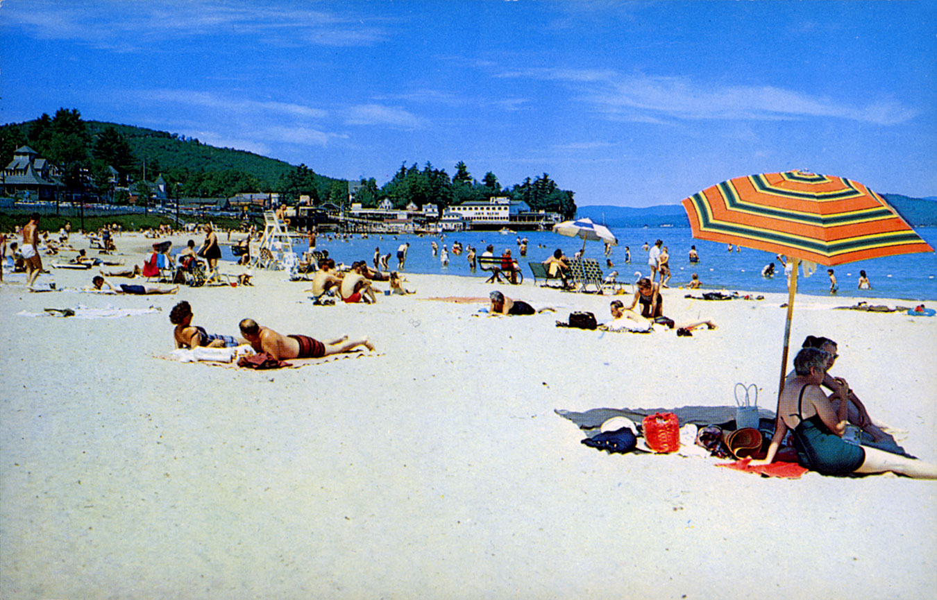
#7 Endicott Beach at the Weirs
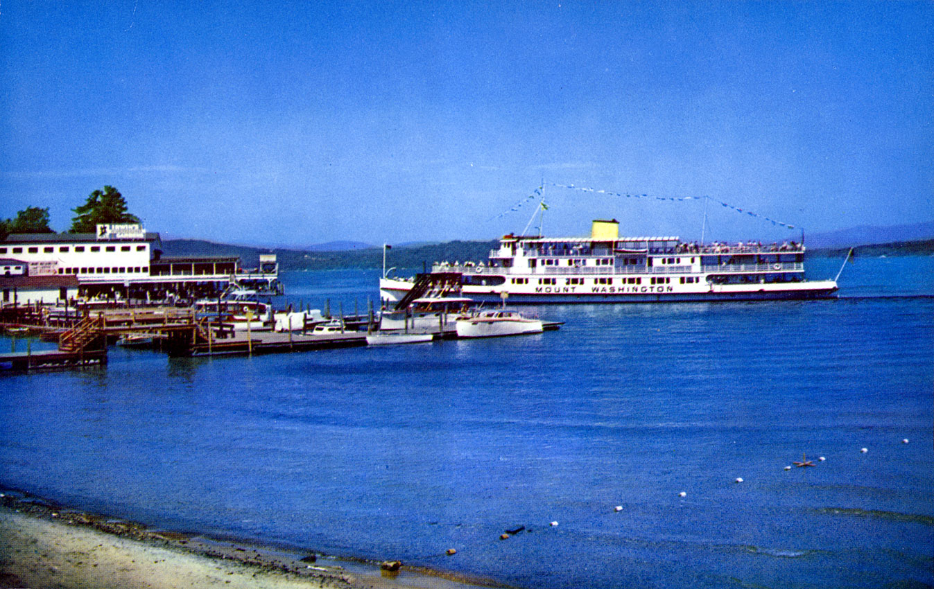
#8 MV Mount Washington at the Weirs
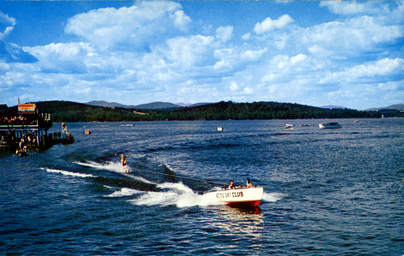
#9 Water Ski Exhibition (Weirs)
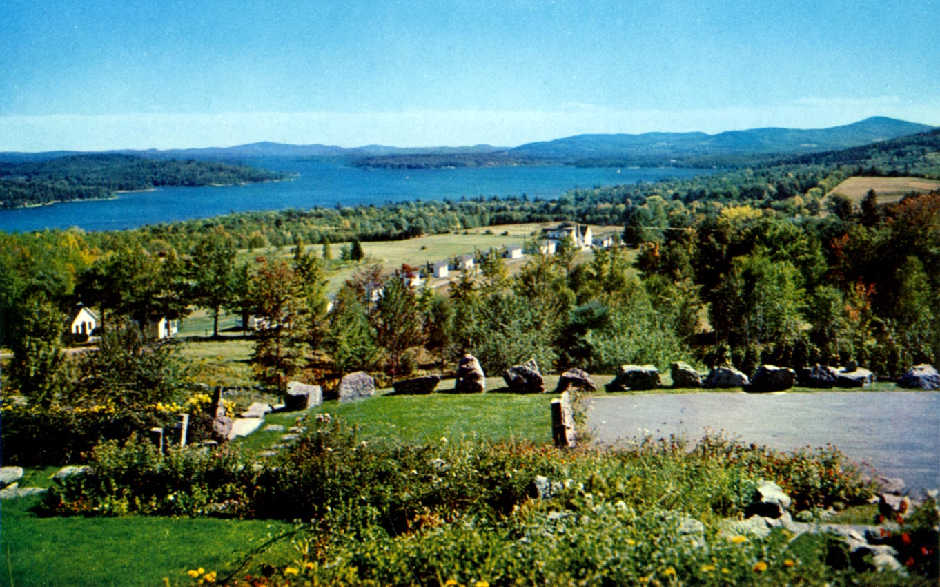
#10 From Meredith Hill (Lochhaven)
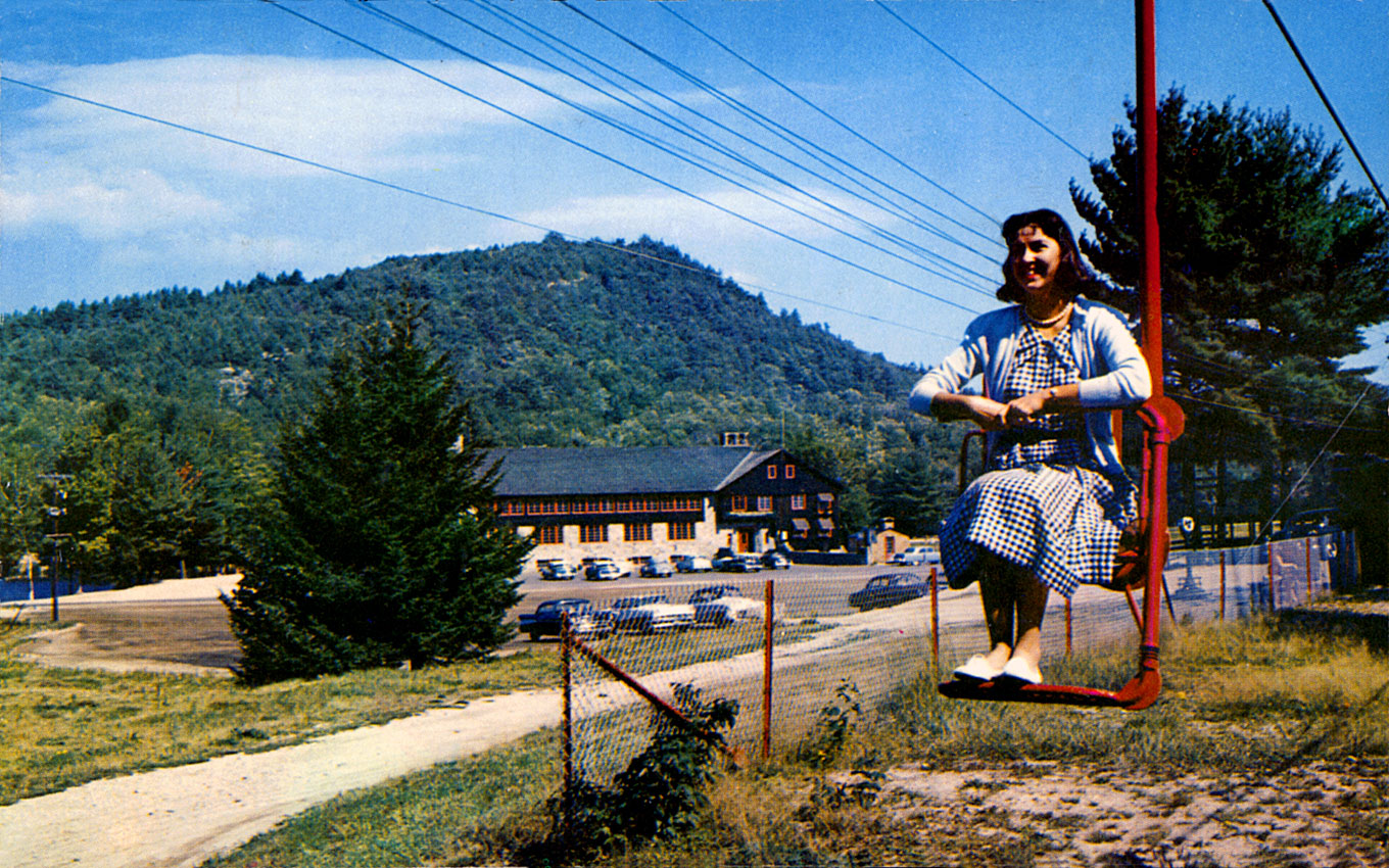
#11 Mt Belknap Chair Lift (Rowe Mountain)
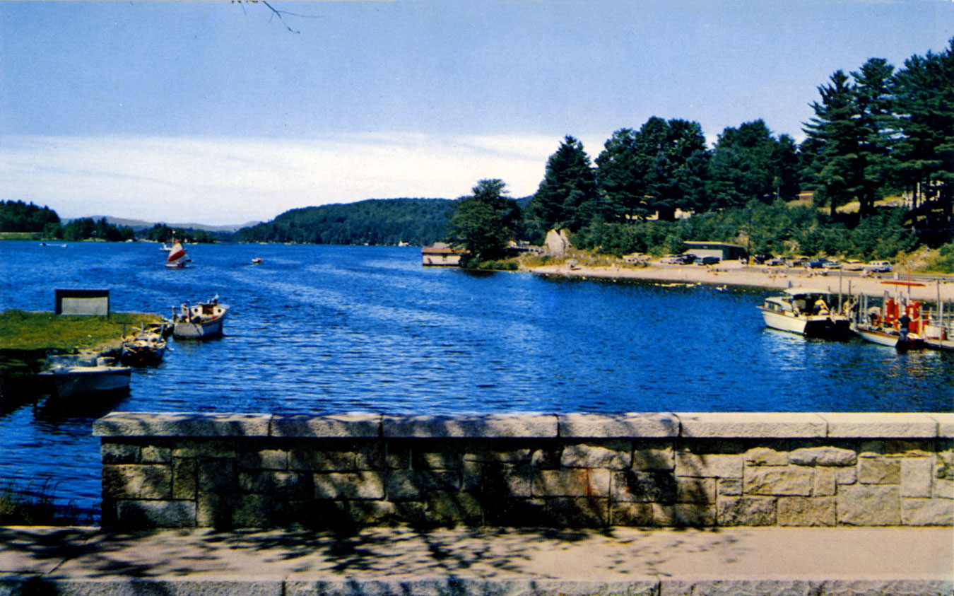
#12 Lake from Alton Bay
For galleries of historical postcards and extensive information about the #11 and #12 multiview subjects, click on the following links:
Belknap Mountain Recreation Area
Alton Bay
Below are bonus historical views of multiview subjects #4 and #6.
Durgin Bridge & Long Island Bridge
The #4 photo was mistakenly identified as the Long Island Bridge in Moultonborough in the caption on the back of the Lake Winnipesaukee multiview postcard. The photo is actually of the Durgin covered bridge, which spans the Cold River in Sandwich, NH. The first bridge in this location was built in 1826. The current bridge was built in 1869 and rehabilitated in 1983. Here are two bonus photos of the Durgin bridge.


Here are several photos of the actual Long Island Bridge in Moultonborough. The first photo was taken in the mid 1970’s by Bill Bardsley. The postcard caption read, “This bridge connects Moultonboro Neck, on the mainland, with Long Island, the largest island in New Hampshire’s largest lake.” The bridge was rebuilt in 1988.


There was definitely no bridge to Long Island until some time after 1864. In that year, a Mr. Dow had to bring his new bride and her possessions across from Long Island in a rowboat to her new home on Moultonborough Neck. The first Long Island bridge was probably built in the 1870s, as it is shown on early maps of the period. This first, early bridge was made of rock and gravel, and proved unsatisfactory because of the strong current in the lake there. Sometime before 1900, it was replaced by a second bridge with concrete piers, seen in the following photo. This was replaced by a third bridge, probably built in the 1930s, as seen in the above color photos.

Dane Farm
According to Bruce Heald in his 2002 book Around Squam Lake, published by Arcadia Publishing, “… this grand farm proudly stands as a landmark on the shore of Lake Winnipesaukee. Ernest B. Dane (1868-1942) and family came to Center Harbor from Brookline, Massachusetts, and purchased most of the farms that came on the market during World War I, thus preserving Center Harbor country village. The Dane farm included many acres bordering Lake Winnipesaukee and was known as the Longwood Farm”. The farm supplied feed for its prize-winning herd of Guernsey cattle and operated a commercial dairy.
The caption on postcard #6 reads “Longwood Dairy Farm”. Unfortunately, the farm’s lakefront land was too valuable to preserve for farming, so the farm no longer exists. Just before reaching Center Harbor on Route 25 from Meredith, one sees on the right that the former farm pasture land is now the site of several elaborate private homes.
The farm had three separate barns. Its large barn that housed the adult Guernsey cows was torn down in 1978, as was the small barn, the calf barn. The middle-sized dairy barn still exists, next to Canoe Restaurant, and features a cow-shaped copper weathervane.
Tbe Danes were very rich. They owned an 80 acre estate in Brookline, a 240′ yacht, and properties in Halifax, MA; Seal Harbor, ME; and Quebec. Between 1913 and 1932 they amassed together 46 separate Center Harbor properties, many of them small, former farms. They owned 1500 acres on Red Hill. They built their “Hillcrest” home at the highest point atop the old road to Meredith. That road, Route 25B, is now named Dane Rd after them.
A view of Dane Farm from an article in National Geographic Magazine of the late 1930’s titled “New England’s Wonderland of Mountain, Lake and Seascape”. The caption on the photo read “Quarters for Blooded Stock on Lake Winnipesaukee”.

A postcard entitled “Lake Winnipesaukee from Coe Hill, Center Harbor” shows the Dane Farm at the bottom of the hill.

A close up of the Dane Farm barn, with the Ossipee Mountains seen across Center Harbor bay.

A closer view shows a portion of the Dane Farm barnhouse and what could be the farmhouse to the right.

An old postcard entitled “Winnipesaukee from Garnet Hill, Center Harbor, N.H. ” shows a portion of the barnhouse and possible farmhouse.

An aerial photo of Center Harbor from the early 1960s shows Dane Farm situated on a very undeveloped waterfront. Squam Lake is seen in the distance.
The two islands seen in the bay directly in front of the farm are both named Half Mile Island. To distinguish them further, the island closest to the farm is Half Mile Island West and the one further out in the bay is Half Mile Island East.

A very old postcard view shows the Half Mile islands right offshore, of what was then called Gilnockie Barns.

A view of Red Hill from the Dane farm

A very old view of Red Hill. Main Street was just a simple dirt road at the time. Plymouth Street veers uphill on the left.

“At the Gateway” promotional card for the farm’s Guernsey cattle.

Early stereoviews, taken from the approximate location of Dane Farm.

