


Laconia-Lakeport Aerial Photo Collection
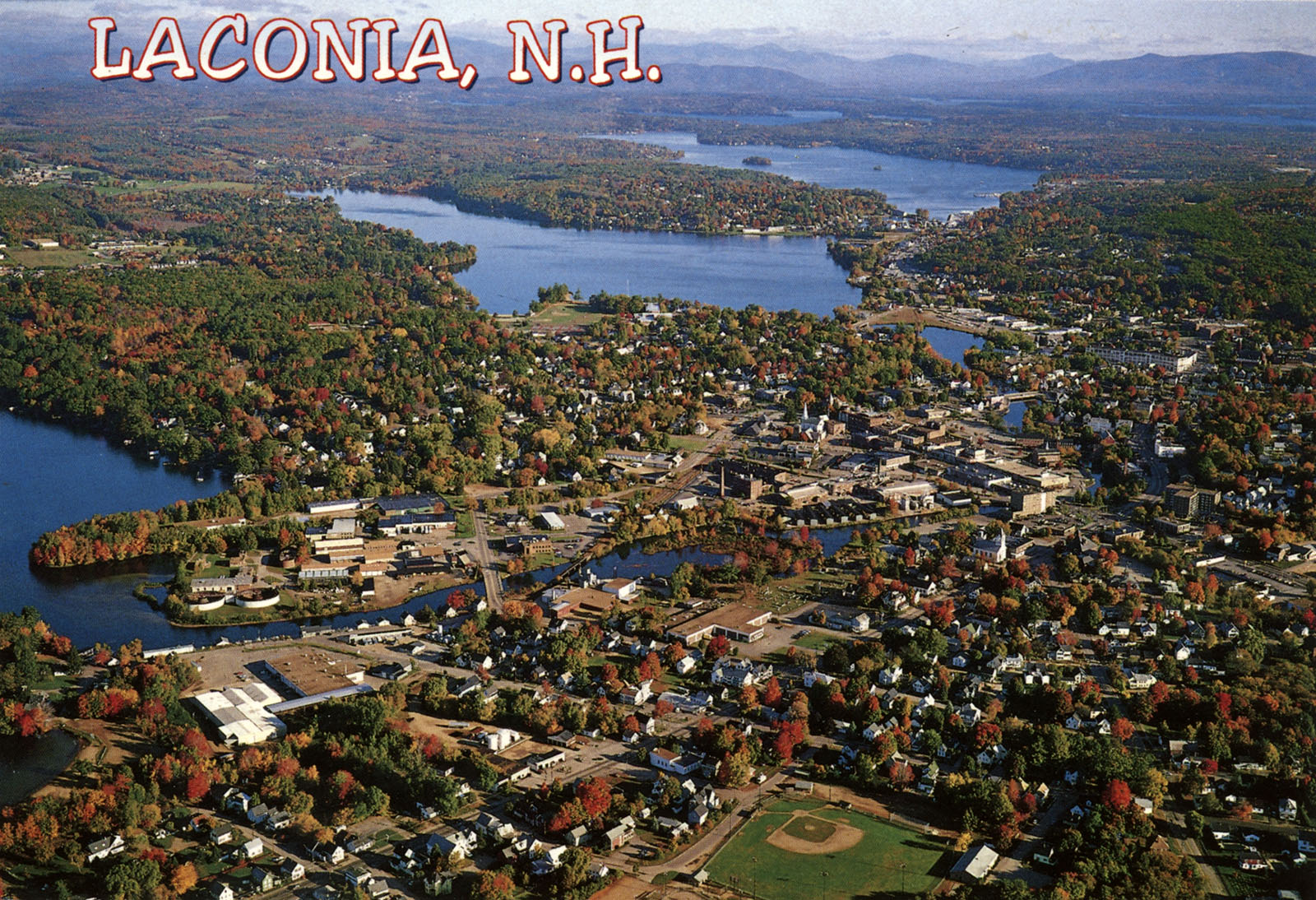
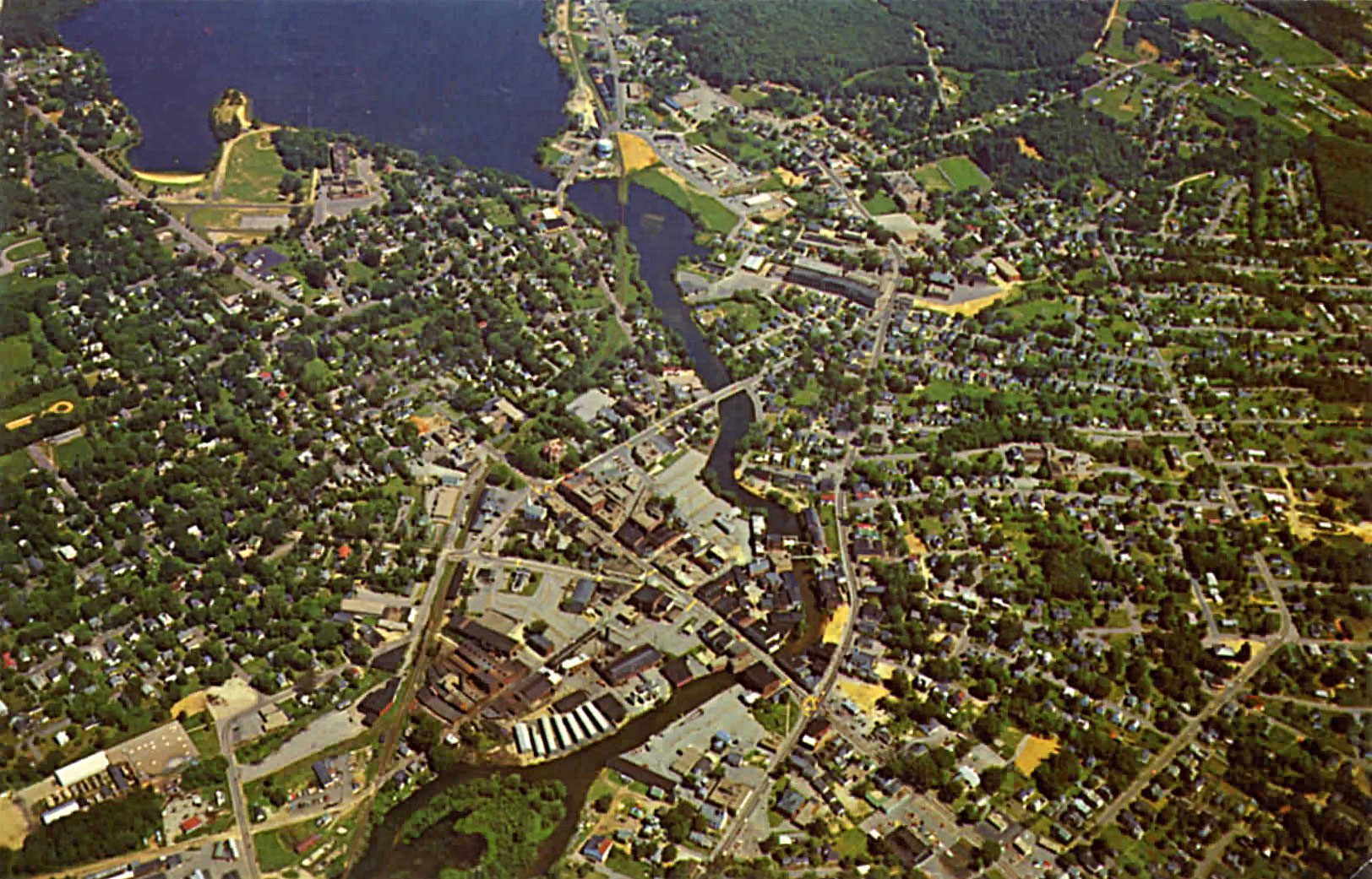
#6 Lakeport, Opechee and Paugus (and Downtown Laconia)
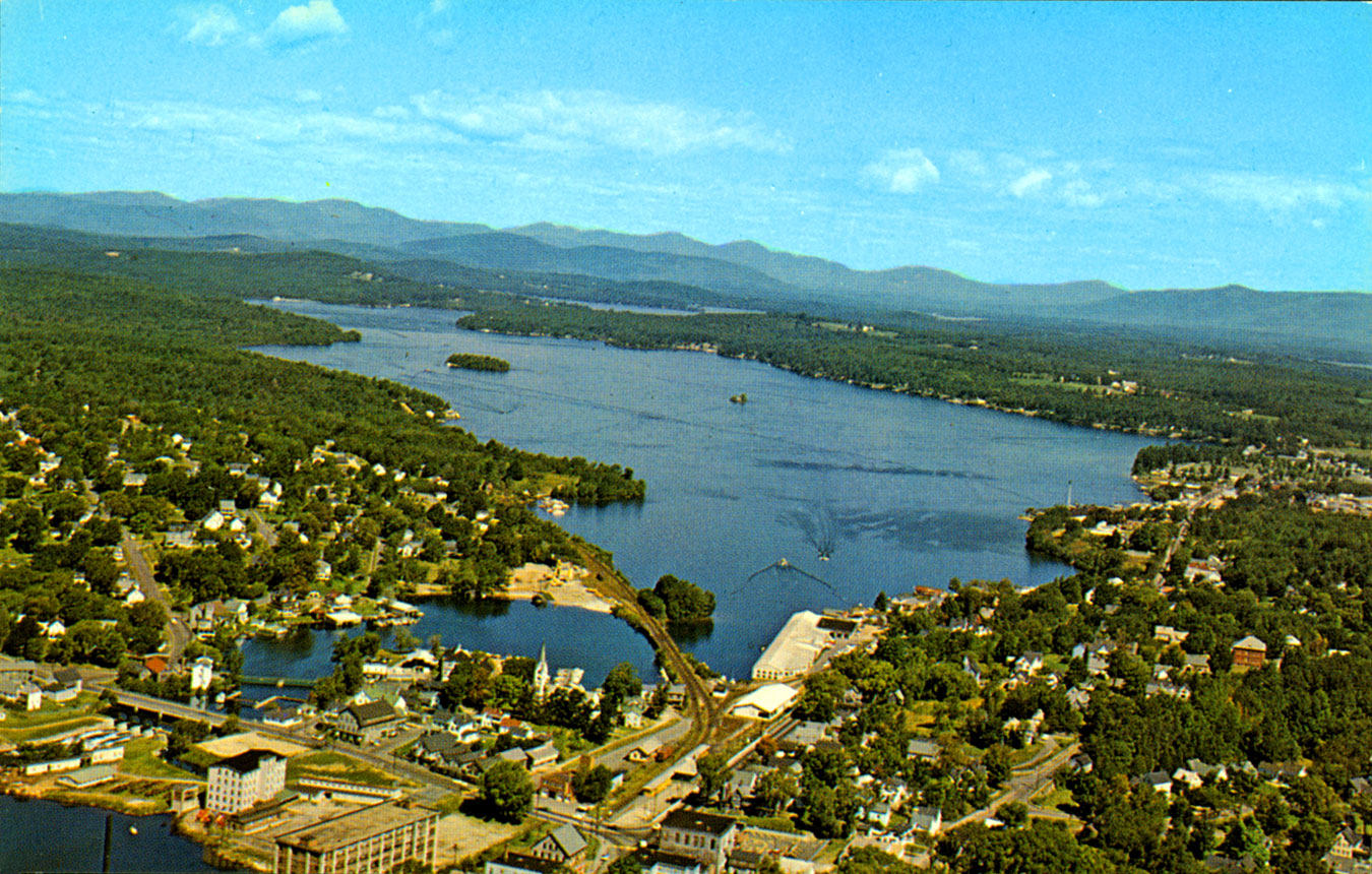
Alternate view looking North of Paugus Bay, taken by Frank Forward. 1960s.
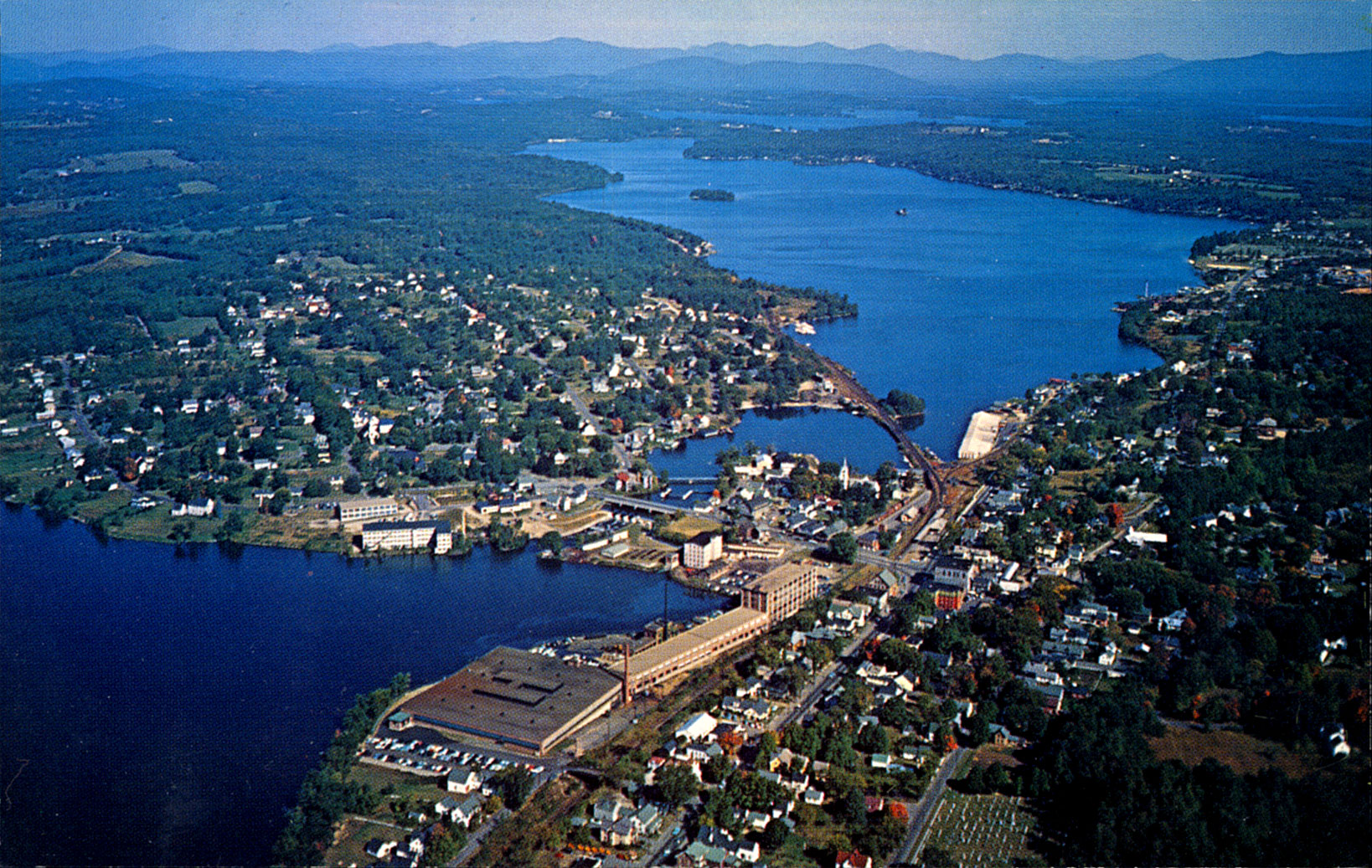
Alternate view looking North, taken by Dick Smith. 1960s.
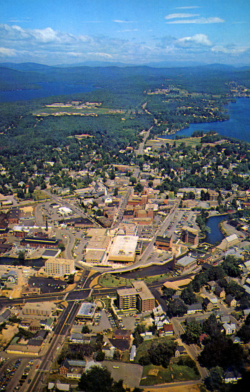
Alternate view looking North taken by Jim Abts. 1990s.
A similar view looking North taken by Jim Abts.
View of downtown Laconia, 1990s, by Jim Abts.
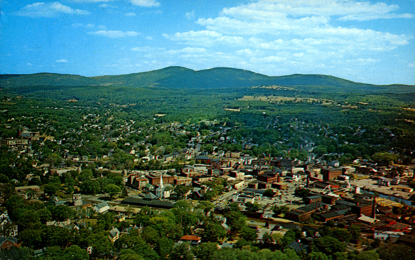
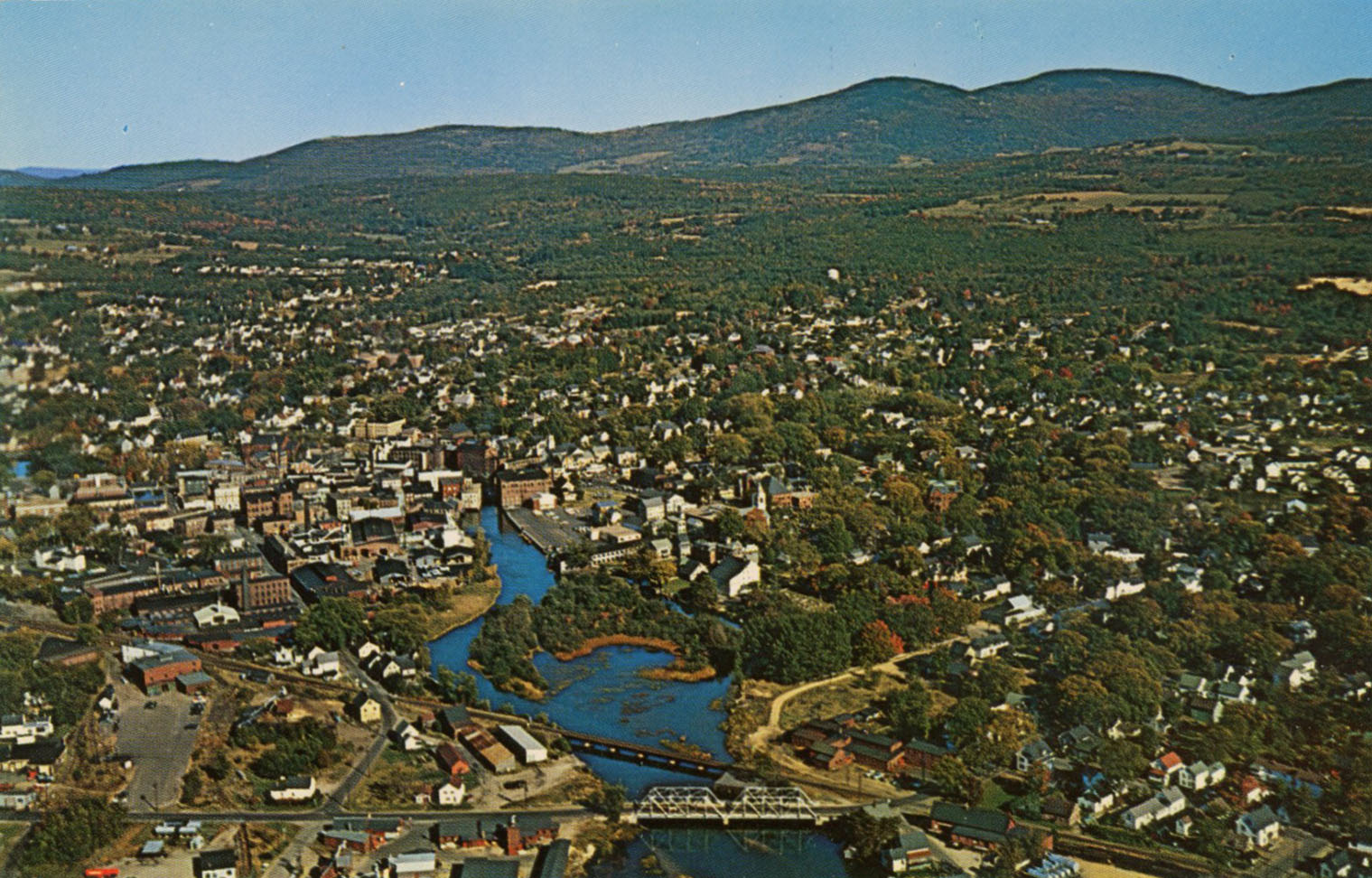
Aerial view of downtown Laconia in Northeast direction towards the Belknap mountains. 1960s.
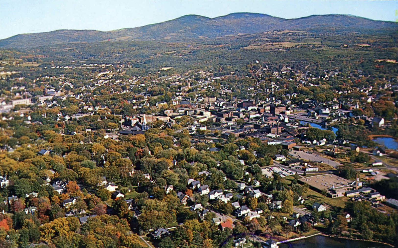
Alternate view of downtown Laconia in Northeast direction. 1960s.
View of downtown Laconia, looking nearly straight down. 1960s.
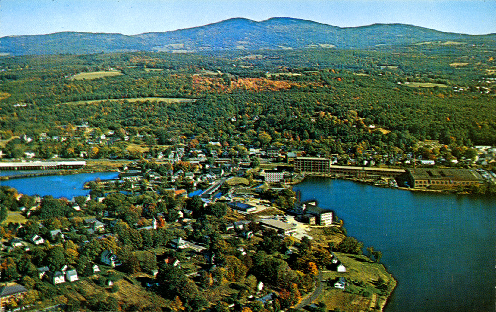
View of Lakeport by Frank Forward, looking towards the Belknap mountains. 1960s.
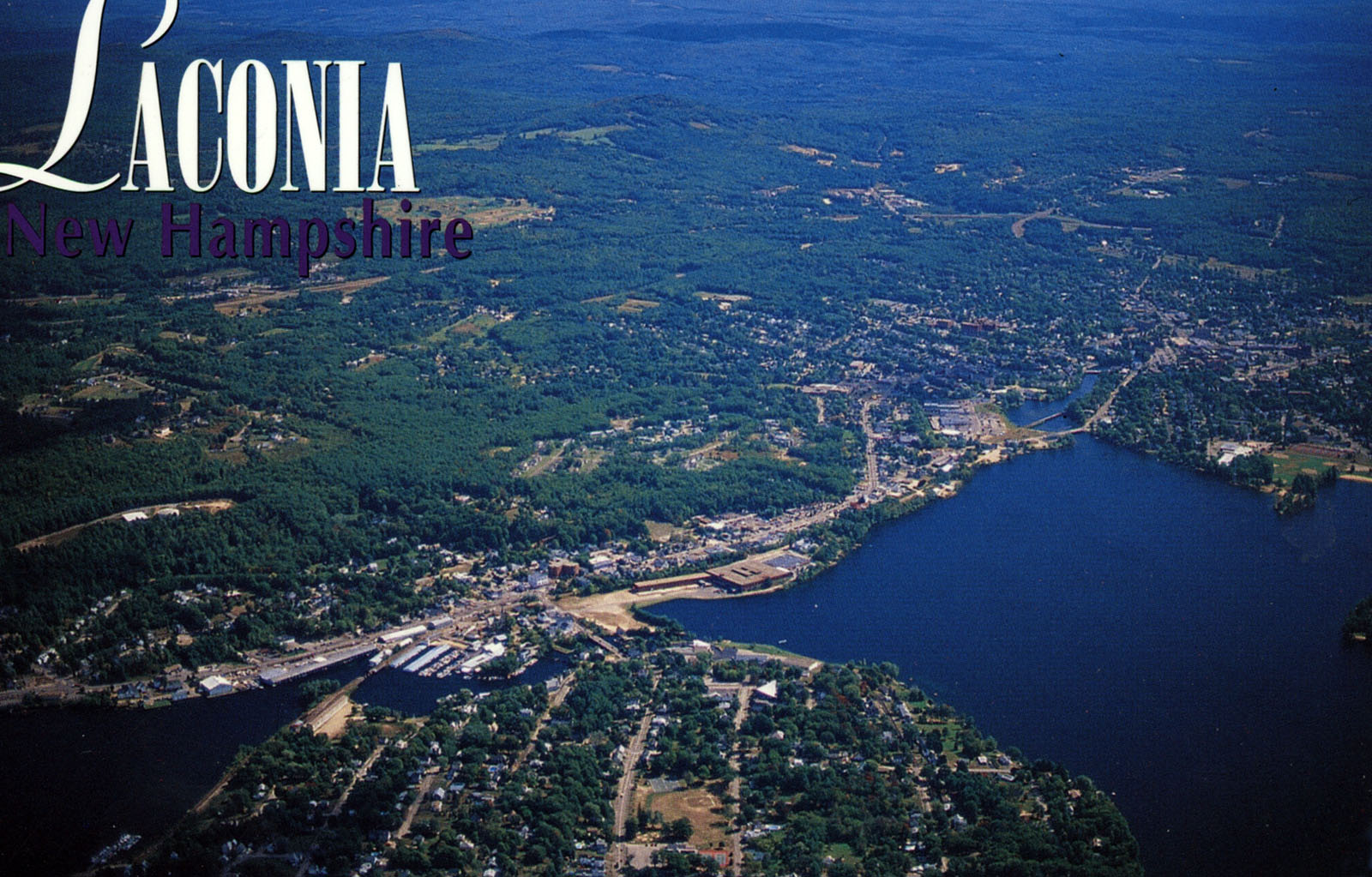
View of Lakeport, 1980s.
Close-up view of downtown Laconia, 1950s.
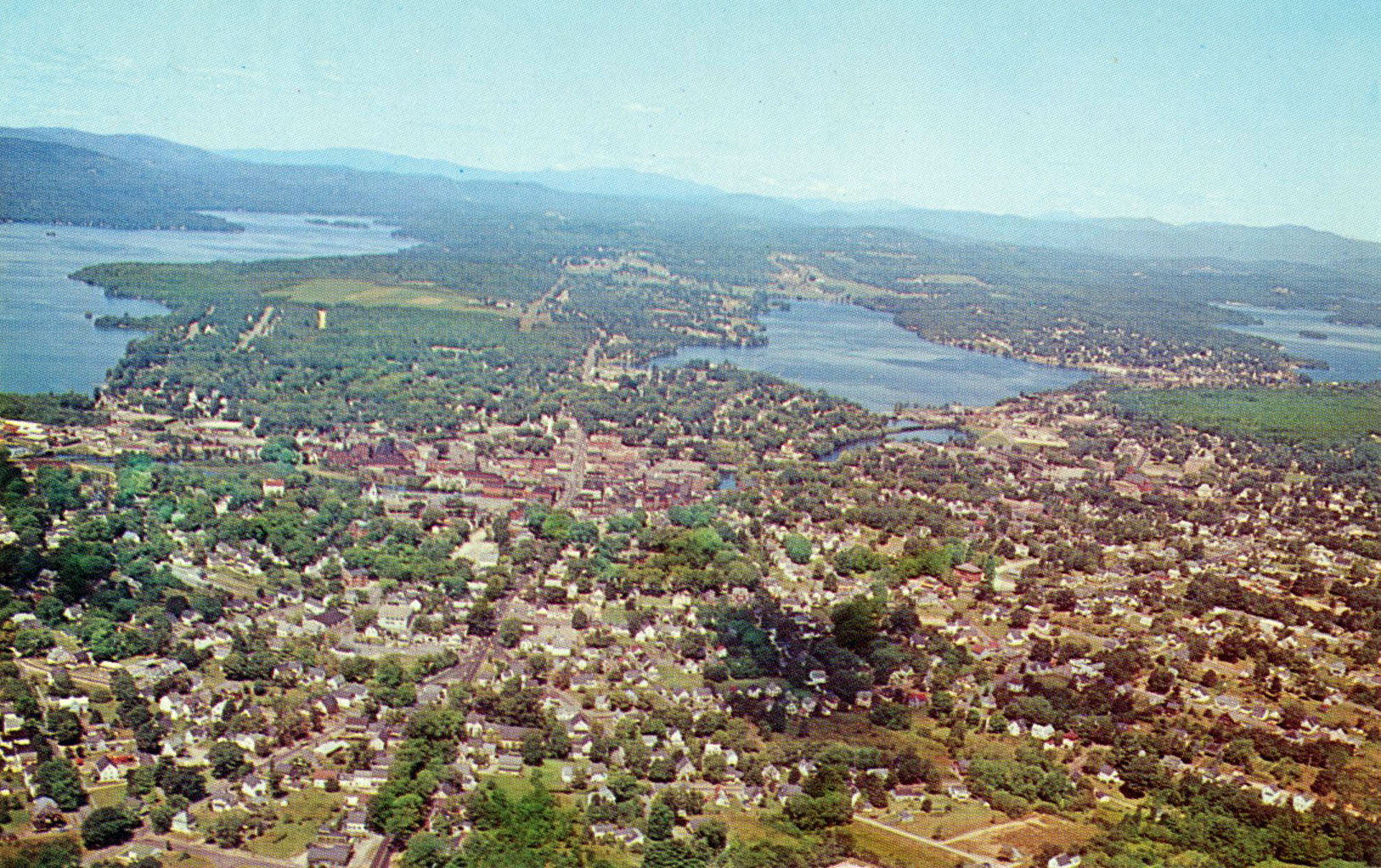
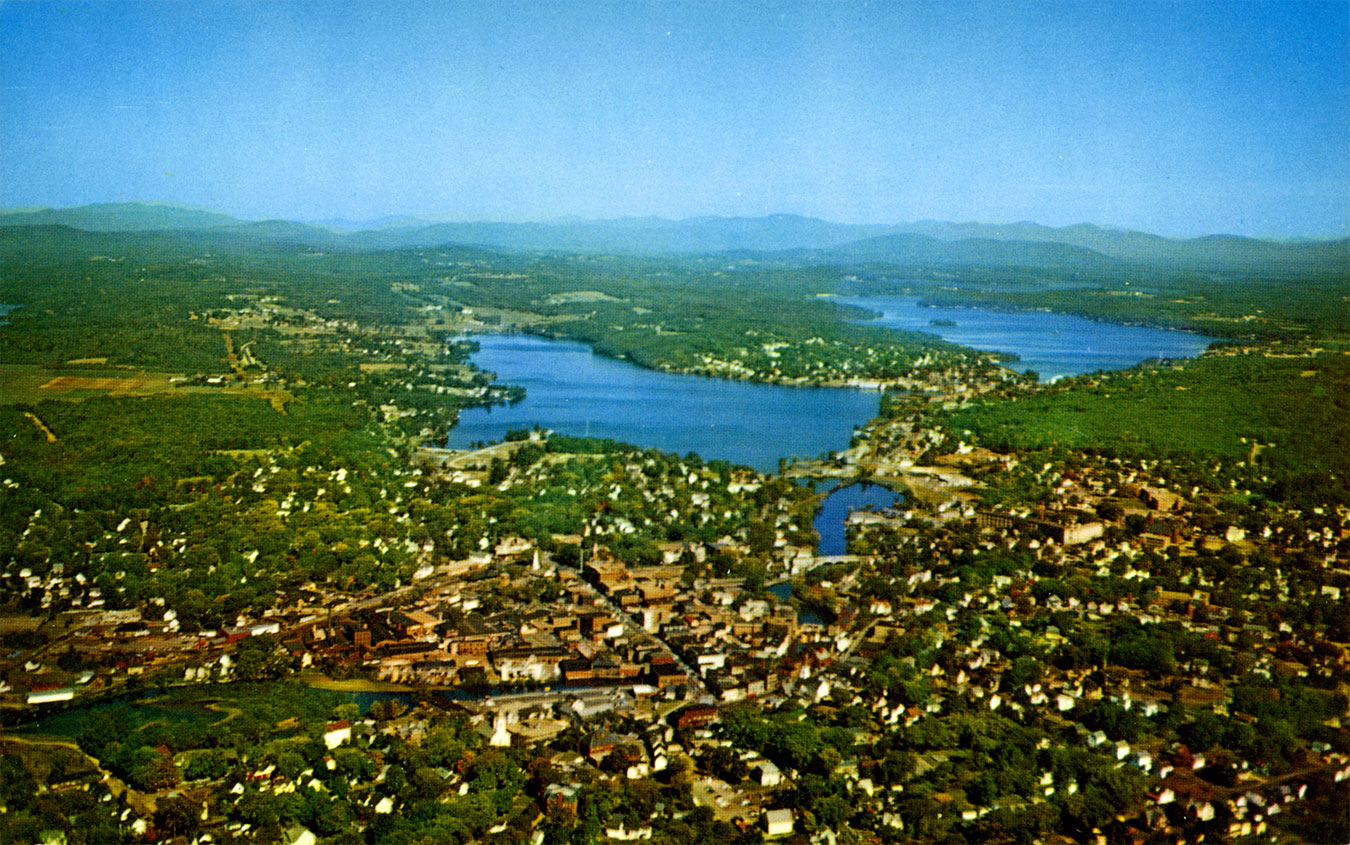
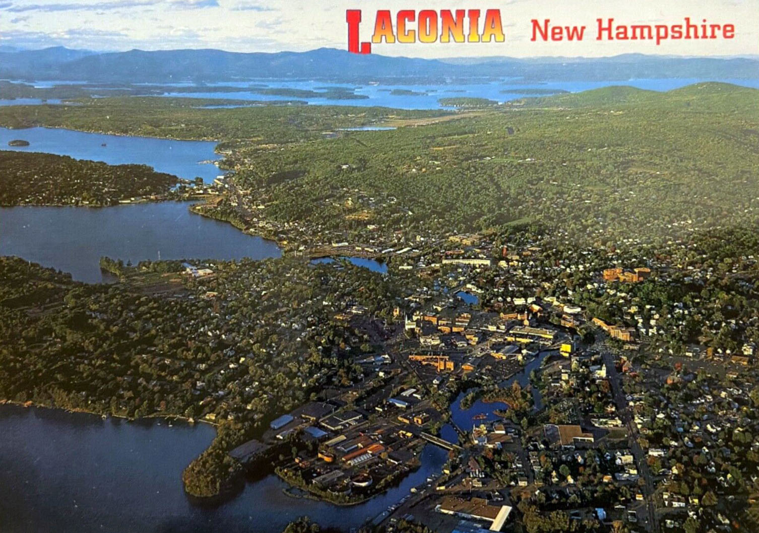
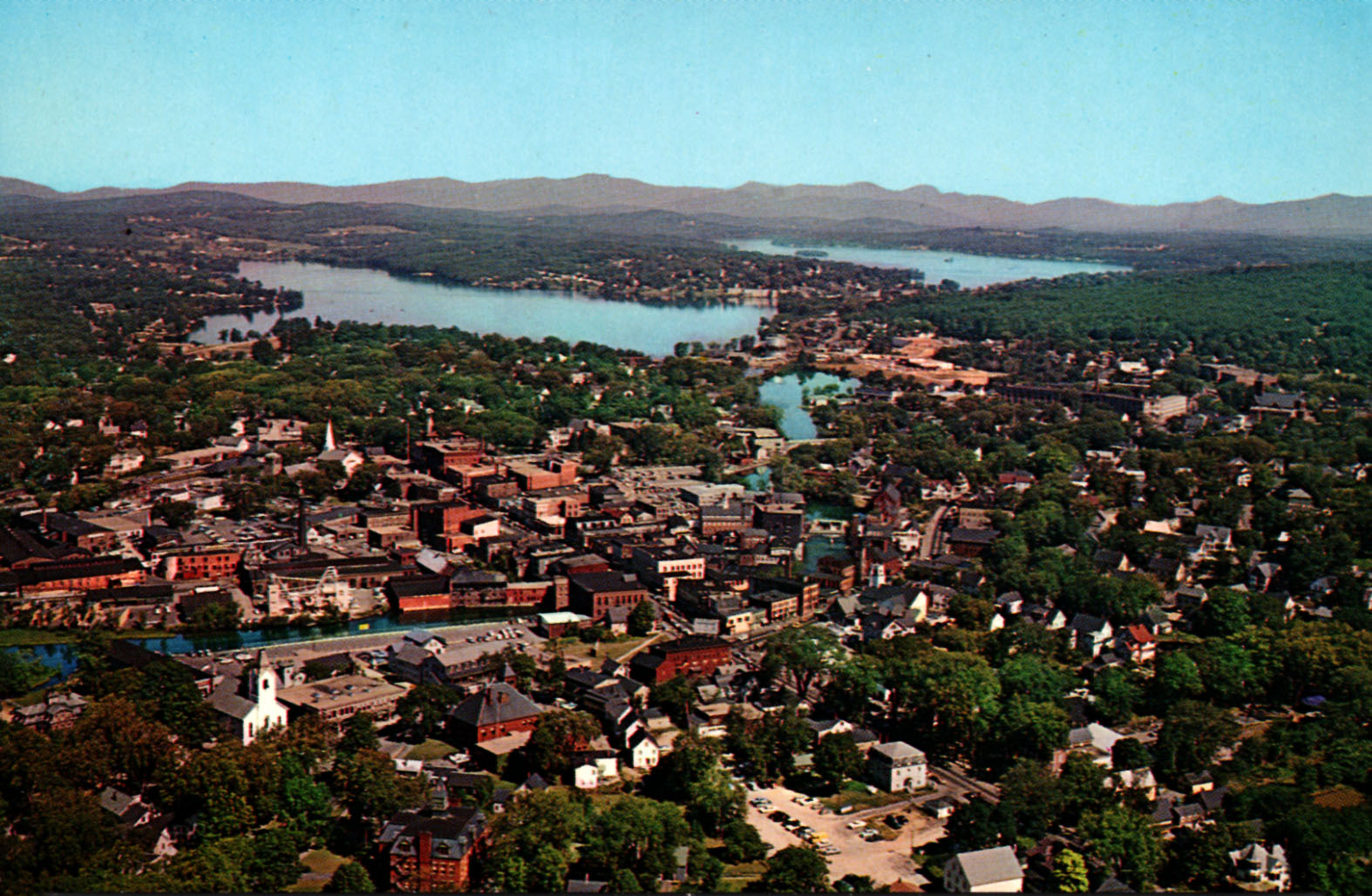
Wide view of Laconia, 1950’s, includes all the lakes and mountains.
View of the Fair Street crossing in the 1950s.
View of downtown Laconia towards the Northwest. Taken circa 1976, after urban renewal.
Lakeport in the 1940s

Close up of the railroad crossing in Lakeport in the 1940s

View of downtown Laconia in the 1940s

In the mid-1920s, aerial photographer E.D. Putnam took the earliest aerial photos known of Laconia, Lakeport, and Weirs Beach. Below is a gallery of Putnam’s photos of Laconia and Lakeport.
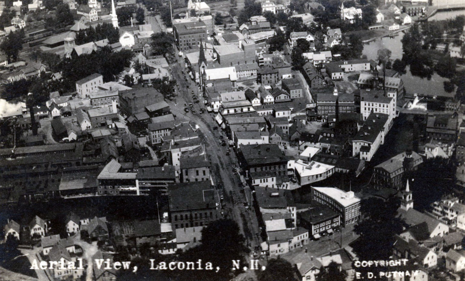
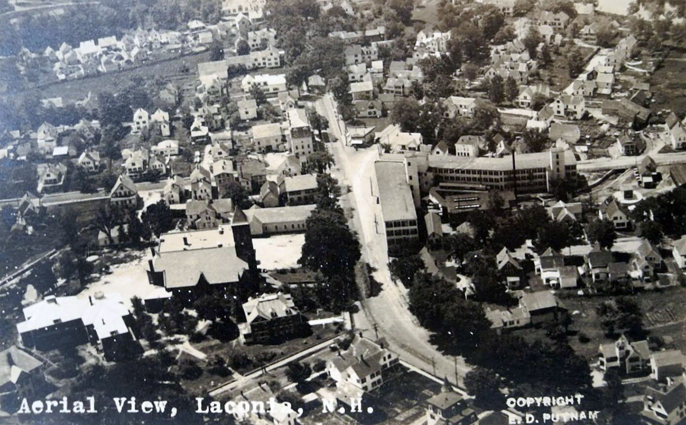
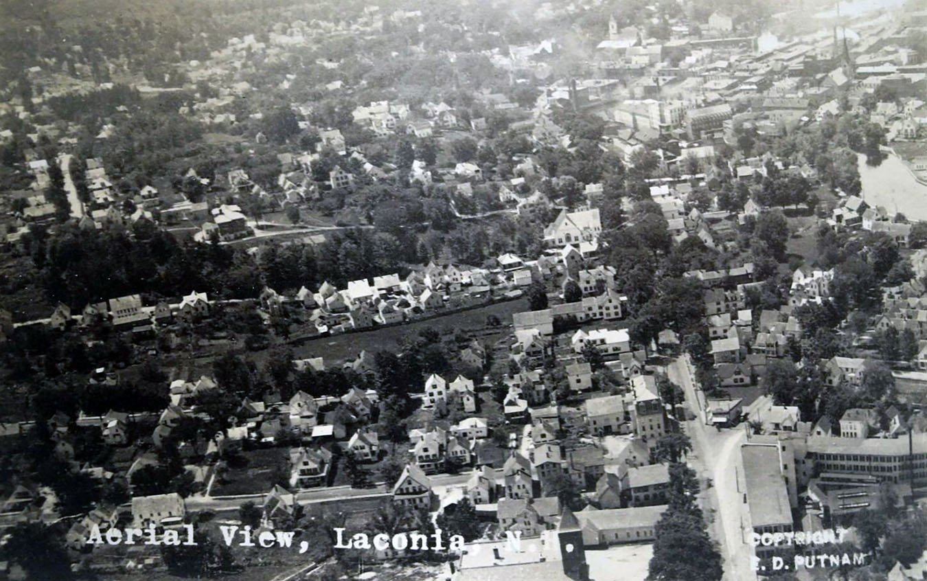
Main Street, downtown Laconia, Bank Square at center.
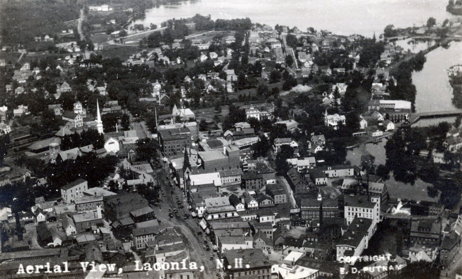
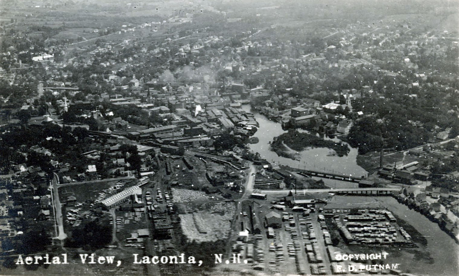
Main Street and the Mills in more detail. Includes Opechee Point.
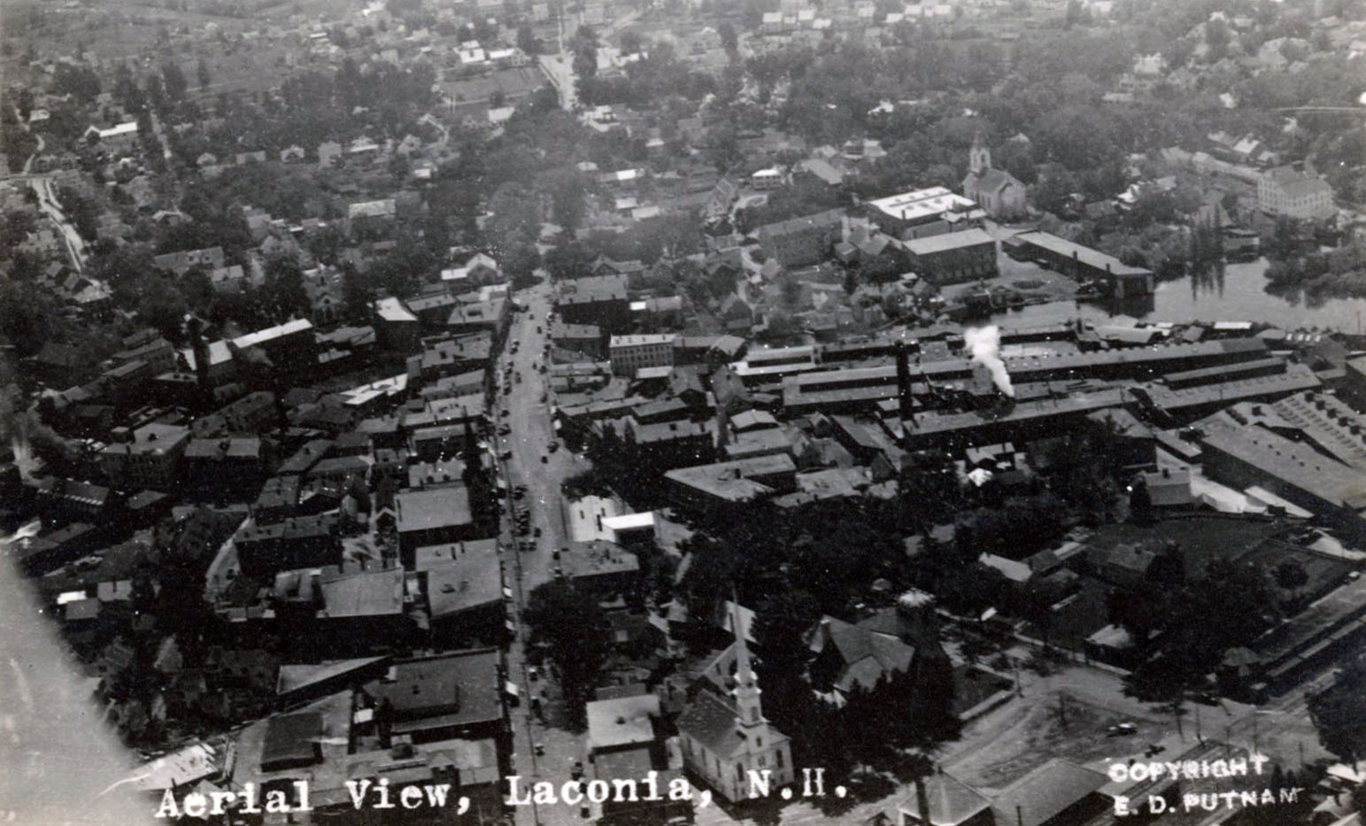
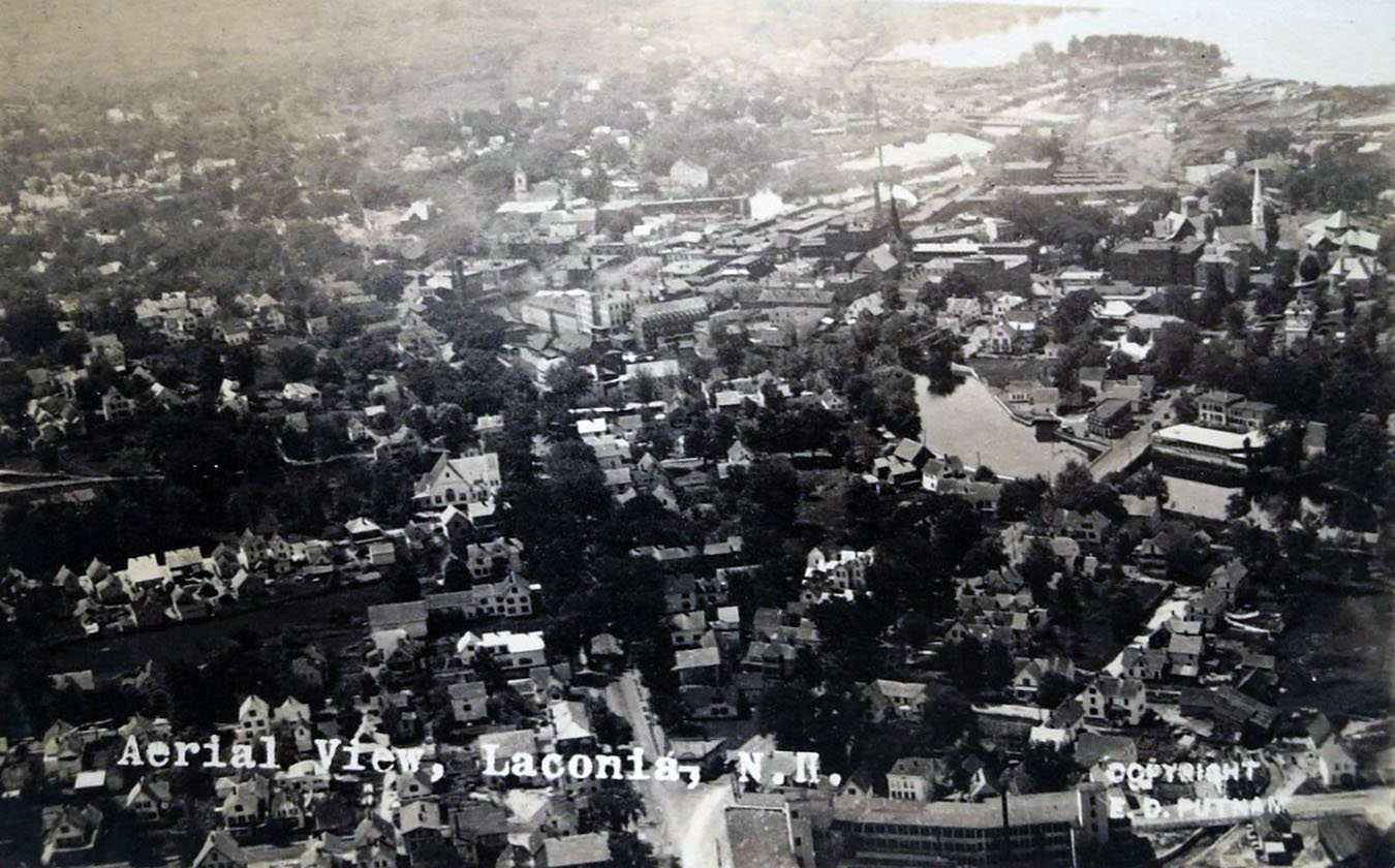
Main Street from the opposite direction, looking South. The roofs of the Laconia Car Company, known colloquially as the Car Works, are seen clearly.
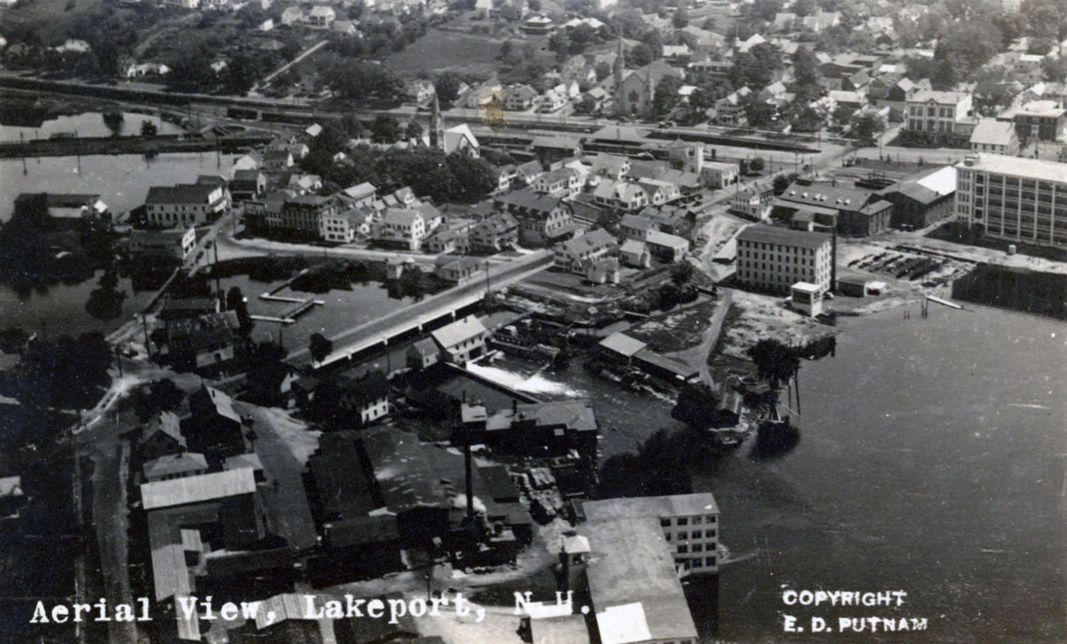
Aerial view of Lakeport.
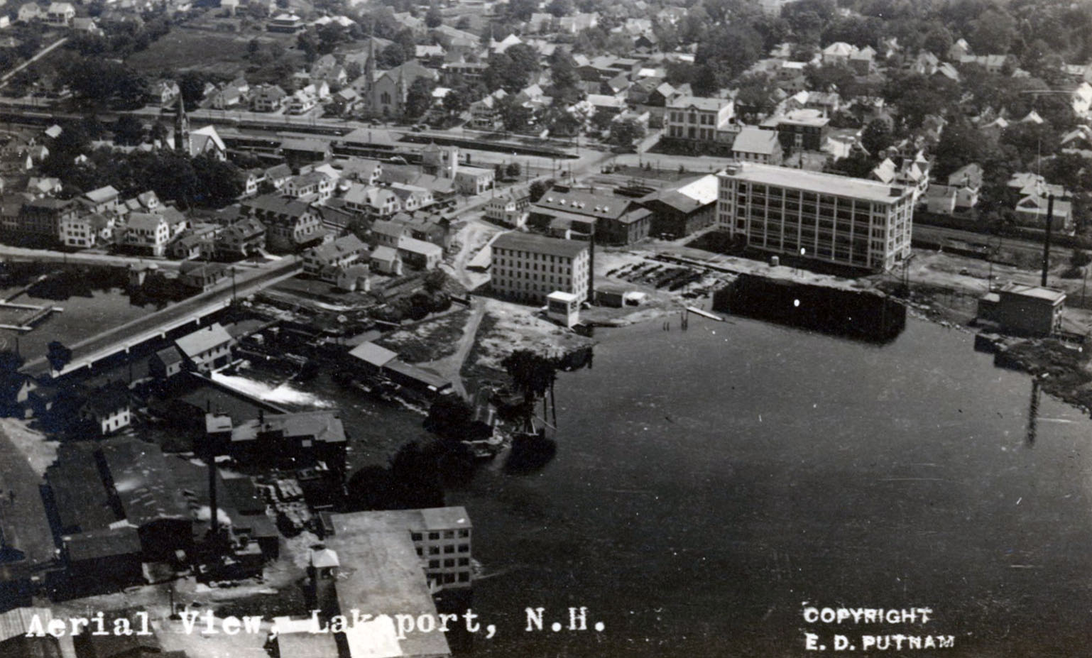
Alternate view of Lakeport.
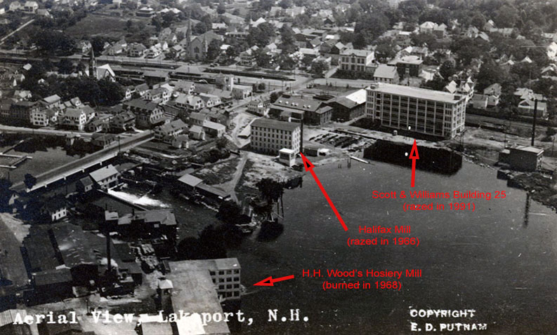
Annotated view of Lakeport aerial.
The Fair Street Crossing in the 1920s.
View #1 of Normandin Square. This is the fork at the intersection of Union Avenue and Church Street.
View #2 of Normandin Square, partly visible at bottom center of photo.
View #3 of Normandin Square, seen in lower right of photo.
Normandin Square
At the time of the Normandin Square aerials, this location was known as Casino Square. The Casino name came from a late-1800’s roller skating rink. Back then, the word “casino” meant any public gathering place used for pleasurable activities. The word only became associated exclusively with gambling in the 20th century.
On December 26, 1948, the square was renamed in honor of Dr. Armand Normandin, an obstetrician who had delivered many Laconia babies. (Just past the square, F.E. Normandin founded his law firm, now known as Normandin, Cheney & O’Neil, in 1914.)
The square also became known as Busy Corner, when in 1917 a store of the same name was built directly on the fork at the intersection of Union Avenue and Church Street. The store can be seen in these aerial views. The Busy Corner store was torn down in 2016 to make way for a CVS drug store.
The Busy Corner store in the early 1940s. Union Avenue on left, Church Street on right.

Clearly visible at the center of the aerials are the large buildings of the Scott & Williams factory, which manufactured knitting machinery. In 2005, the main building of the former factory, which ran along Davis Place, was converted into 60 residential units. The ell wing that fronted on Union Avenue was torn down to provide more parking and better visibility for the development. In mid-May, 2006, the new residents of the Normandin Square Apartments moved in.
An 1890s, real estate development firm, the Casino Building Company, built a 3-story, wooden factory building in 1896 “on speculation”, without a tenant. In February, 1897, the Waverly Shoe Company moved in. The photo is from the 1899 “Illustrated Laconian”. In November of 1899, the company moved out, complaining that the freight rates of the Boston & Maine railroad were too high.

The factory building sat vacant for several years while the building owners looked for a new tenant. In 1903, the George D. Mayo Machine Company, a manufacturer of knitting machines from Franklin, moved in.

An old postcard of Casino Square postmarked in 1908.

Another old postcard of Casino Square, showing the Laconia Street Railway trolley just leaving the square.

Mayo Machine Shops, Laconia, N.H.

The George D. Mayo Machine Company was acquired by Scott & Williams in 1910. The original, wooden factory building is seen in a white border postcard, after it had been renamed Scott & Williams Inc. in 1912, and after a large wooden ell wing had been added to the factory in 1916.

In 1929, Scott & Williams tore down the original, 3-story wooden factory building. In 1930, the company moved into its replacement, a 4-story, steel and concrete structure. Below is a contemporary photo of the newer building, taken on June 1, 2026. The view looks straight down Davis Place, while Union Ave runs from left to right in the foreground.

The wooden ell wing fronted Union Avenue. It stretched all the way from the main factory on Davis Place to Strafford St.

The wooden ell wing was also rebuilt in steel and concrete in 1929-1930. This was its appearance when torn down in 2005.

Below is a contemporary view of the Normandin Square apartments building along its Strafford Street side. Union Avenue runs left to right in the foreground. Strafford Street is just off-photo on the right. The guardrail barrier in the lower left of the photo is for Jewett Brook. The brook runs alongside the building, about 2/3 of the way down its length, then crosses diagonally underneath the building. Still hidden while crossing under the Davis Place bridge, the brook emerges on the other side of the street, where it continues a short distance through woods before emptying into the Winnipesaukee River. The Davis Place bridge was rebuilt in 2006. The Union Avenue bridge over Jewett Brook was built in 1978-1979, replacing a 1913 bridge.
Jewett Brook begins in the hills above town, then runs under the following four bridges: the Highland Street bridge (NH DOT Bridge #130/056), built in 1989; the Union Avenue bridge (126/055); the Davis Place bridge (124/055); and finally, a bridge on a discontinued street about 100′ downstream of Davis Place. This final bridge is closed to traffic but still open for pedestrian use.

The outlet of Jewett Brook where it empties into the Winnipesaukee River.

The Fair Street Crossing
The 1920s aerial photo of the Fair Street Crossing shows two bridges crossing the Winnipesaukee River just south of downtown. Seen are the first street bridge, which was built circa 1883, and the railroad bridge, built in 1893.
The railroad bridge crosses the Winnipesaukee River on a 228-foot long, multi-span, deck plate, steel girder bridge. The six spans are supported by low stone and concrete piers and abutments. In 2015, the timber bridge deck was replaced, and a sidewalk and guardrail were removed. Each of the 165 cross tie timbers replaced weighed 300-400 lbs. The sidewalk had been there for conductors to inspect the connections and brakes when a train stopped on the trestle. With the lack of heavy freight service, the sidewalk was no longer needed.
The color aerial shows the railroad bridge as well as the second street bridge. The steel truss street bridge was built in 1927. This second bridge closed on October 24, 1972. A new, modern Fair Street Bridge for vehicle traffic opened on June 6, 1973. The new Fair Street Bridge deck was replaced in 2007.
A convoy of rail bikes crossing the Fair Street Bridge on a beautiful fall day in 2025. The rail bikes can be rented from the Granite State Railway here.
