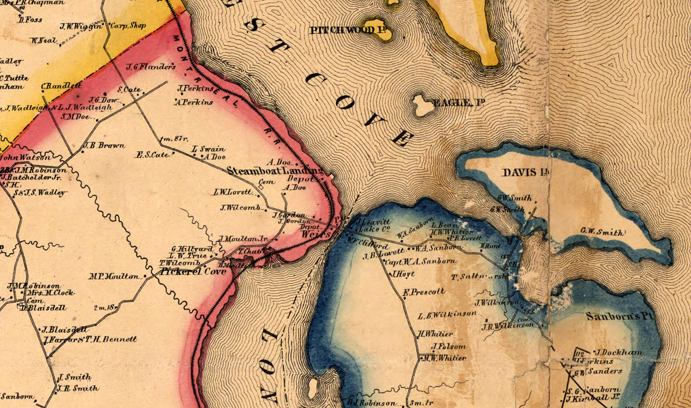
Weirs Steamboat Landing
Detail from an 1860 map of Belknap County, published in Philadephia by Smith and Peavey, compiled and drawn from surveys by E. M. Woodford. Note that there were two depots in Weirs Beach at the time. The map also shows the location of the post office (P.O.). It was at the “Old Red House“. Meredith Bay is called “North West Cove”. Governor’s Island is Davis Island. Laconia is outlined in red and Gilford in blue. At this time Laconia was a village that did not include any land east of the Winnipesaukee River. For the complete map, click here.


